| Apaporis River | |
|---|---|
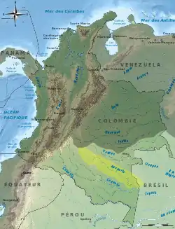 Apaporis drainage basin | |
| Native name | Rio Apaporis (Portuguese) |
| Location | |
| Countries | |
| Physical characteristics | |
| Source | |
| • location | Confluence of the Ajajú and Tunía River, Caquetá, Colombia |
| Mouth | |
• location | Japurá River, Amazonas, Brazil |
• coordinates | 1°22′34″S 69°25′10″W / 1.376147°S 69.419475°W |
| Length | 960 km (600 mi) |
| Basin size | 53,509 km2 (20,660 sq mi)[1] 57,430.6 km2 (22,174.1 sq mi)[2] |
| Discharge | |
| • location | Confluence of Caquetá, Brazil, Amazonas State |
| • average | 4,092 m3/s (144,500 cu ft/s)[3] 3,657.463 m3/s (129,162.1 cu ft/s)[4] |
| Basin features | |
| River system | Japurá River |
| Tributaries | |
| • left | Pira Paraná River |
The Apaporis River is a river of the Vaupés Department, Colombia. It is a tributary of the Caquetá or Japurá River. In the last stretch, before the river joins the Caquetá, it forms part of the boundary between Colombia and Brazil.
See also
References
- ↑ Félix Dario, Sánchez; Martha, García; Omar, Jaramillo; Nelsy, Verdugo (2010). "ESTUDIO NACIONAL DEL AGUA 2010 (IDEAM) - Agua Superficial - Caracterización y análísis de la oferta" (PDF).
- ↑ "Rivers Network". 2020.
- ↑ Félix Dario, Sánchez; Martha, García; Omar, Jaramillo; Nelsy, Verdugo (2010). "ESTUDIO NACIONAL DEL AGUA 2010 (IDEAM) - Agua Superficial - Caracterización y análísis de la oferta" (PDF).
- ↑ "Rivers Network". 2020.
This article is issued from Wikipedia. The text is licensed under Creative Commons - Attribution - Sharealike. Additional terms may apply for the media files.