| Arkendale | |
|---|---|
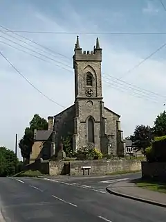 St Bartholomews Church, Arkendale | |
.svg.png.webp) Arkendale Location within North Yorkshire | |
| Population | 394 (2011 census)[1] |
| OS grid reference | SE387610 |
| Unitary authority | |
| Ceremonial county | |
| Region | |
| Country | England |
| Sovereign state | United Kingdom |
| Post town | KNARESBOROUGH |
| Postcode district | HG5 |
| Police | North Yorkshire |
| Fire | North Yorkshire |
| Ambulance | Yorkshire |
Arkendale is a village and civil parish in the Harrogate district of North Yorkshire, England. It is 6 miles (10 km) north-east of Harrogate town,[2] and a had a population of 278 according to the 2001 census,[3] increasing to 394 at the 2011 census.[1] It consists of a Pub,[4] a Village Hall, a Church[5] and is close to Staveley village.
The first part of the toponym originates from Old English eorcnan, meaning probably "precious, noble, true", and cognate to the name Archibald.
References
- 1 2 UK Census (2011). "Local Area Report – Arkendale Parish (E04007306)". Nomis. Office for National Statistics. Retrieved 9 July 2019.
- ↑ "299" (Map). Ripon & Boroughbridge. 1:25,000. Explorer. Ordnance Survey. 2015. ISBN 9780319245514.
- ↑ UK Census (2001). "Local Area Report – Arkendale Parish (36UD003)". Nomis. Office for National Statistics. Retrieved 9 July 2019.
- ↑ Lemm, Elaine (24 May 2015). "Restaurant review: Blue Bell, Arkendale". The Yorkshire Post. Retrieved 9 July 2019.
- ↑ "Arkendale: St Bartholomew - A Church Near You". www.achurchnearyou.com. Retrieved 9 July 2019.
External links
Wikimedia Commons has media related to Arkendale.
This article is issued from Wikipedia. The text is licensed under Creative Commons - Attribution - Sharealike. Additional terms may apply for the media files.