Armagh | |
|---|---|
 | |
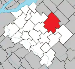 Location within Bellechasse RCM. | |
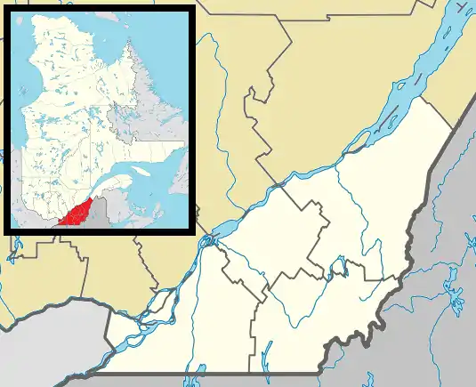 Armagh Location in province of Quebec. | |
| Coordinates: 46°45′N 70°35′W / 46.750°N 70.583°W[1] | |
| Country | |
| Province | |
| Region | Chaudière-Appalaches |
| RCM | Bellechasse |
| Constituted | December 29, 1993 |
| Named for | Armagh[1] |
| Government | |
| • Mayor | Suzie Bernier |
| • Federal riding | Lévis—Bellechasse |
| • Prov. riding | Bellechasse |
| Area | |
| • Total | 170.10 km2 (65.68 sq mi) |
| • Land | 167.99 km2 (64.86 sq mi) |
| Population (2021)[4] | |
| • Total | 1,439 |
| • Density | 8.6/km2 (22/sq mi) |
| • Pop 2016-2021 | |
| • Dwellings | 785 |
| Time zone | UTC−5 (EST) |
| • Summer (DST) | UTC−4 (EDT) |
| Postal code(s) | |
| Area codes | 418 and 581 |
| Highways | |
| Website | www |
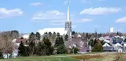
Armagh (2021 Population 1,439) is a municipality in the Bellechasse Regional County Municipality in the Chaudière-Appalaches region of Quebec. Its coordinates are 46°45′N 70°35′W / 46.750°N 70.583°W.
Demographics
Canada census – Armagh community profile
| 2021 | 2011 | |
|---|---|---|
| Population | 1,439 (-3.3% from 2016) | 1,491 (-7.6% from 2006) |
| Land area | 167.99 km2 (64.86 sq mi) | 168.36 km2 (65.00 sq mi) |
| Population density | 8.6/km2 (22/sq mi) | 8.9/km2 (23/sq mi) |
| Median age | 52.8 (M: 52.0, F: 53.2) | 50.5 (M: 49.5, F: 51.5) |
| Private dwellings | 785 (total) 686 (occupied) | 787 (total) |
| Median household income | $55,200 | $35,546 |
References
- 1 2 "Banque de noms de lieux du Québec: Reference number 199383". toponymie.gouv.qc.ca (in French). Commission de toponymie du Québec.
- ↑ "Répertoire des municipalités: Geographic code 19037". www.mamh.gouv.qc.ca (in French). Ministère des Affaires municipales et de l'Habitation.
- ↑ "Data table, Census Profile, 2021 Census of Population - Ange-Gardien, Municipalité (MÉ) [Census subdivision], Quebec". 9 February 2022.
- ↑ "Data table, Census Profile, 2021 Census of Population - Ange-Gardien, Municipalité (MÉ) [Census subdivision], Quebec". 9 February 2022.
- 1 2 "Electronic Area Profiles". Canada 1996 Census. Statistics Canada. Retrieved 2014-01-28.
- ↑ "2021 Community Profiles". 2021 Canadian Census. Statistics Canada. February 4, 2022. Retrieved 2023-10-19.
- ↑ "2011 Community Profiles". 2011 Canadian Census. Statistics Canada. March 21, 2019. Retrieved 2014-01-28.
- ↑ "2006 Community Profiles". 2006 Canadian Census. Statistics Canada. August 20, 2019.
- ↑ "2001 Community Profiles". 2001 Canadian Census. Statistics Canada. July 18, 2021.
External links
Adjacent Municipal Subdivisions | |
|---|---|
| Municipalities | |
|---|---|
| Parishes | |
| |
This article is issued from Wikipedia. The text is licensed under Creative Commons - Attribution - Sharealike. Additional terms may apply for the media files.