Arville | |
|---|---|
Part of Couëtron-au-Perche | |
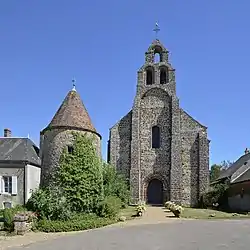 Church of Our Lady | |
 Coat of arms | |
Location of Arville | |
 Arville  Arville | |
| Coordinates: 48°03′49″N 0°56′53″E / 48.0636°N 0.9481°E | |
| Country | France |
| Region | Centre-Val de Loire |
| Department | Loir-et-Cher |
| Arrondissement | Vendôme |
| Canton | Le Perche |
| Commune | Couëtron-au-Perche |
| Area 1 | 9.75 km2 (3.76 sq mi) |
| Population (2019)[1] | 93 |
| • Density | 9.5/km2 (25/sq mi) |
| Time zone | UTC+01:00 (CET) |
| • Summer (DST) | UTC+02:00 (CEST) |
| Postal code | 41170 |
| Elevation | 157–204 m (515–669 ft) |
| 1 French Land Register data, which excludes lakes, ponds, glaciers > 1 km2 (0.386 sq mi or 247 acres) and river estuaries. | |
Arville is a former commune in the Loir-et-Cher department in central France. On 1 January 2018, it was merged into the new commune of Couëtron-au-Perche.[2]
Sights
Arville's 12th-Century commandry now hosts a museum on the Crusades and the Knights Templar.
Population
|
|
See also
References
- ↑ Téléchargement du fichier d'ensemble des populations légales en 2019, INSEE
- ↑ Arrêté préfectoral 10 July 2017 (in French)
External links
- The Commandry Official site
- Base Mérimée: Search for heritage in the commune, Ministère français de la Culture. (in French)
Wikimedia Commons has media related to Arville (Loir-et-Cher).
This article is issued from Wikipedia. The text is licensed under Creative Commons - Attribution - Sharealike. Additional terms may apply for the media files.