Arzenc-d'Apcher | |
|---|---|
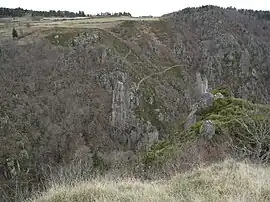 The Gorge of Bès, in Arzenc-d'Apcher | |
Location of Arzenc-d'Apcher | |
 Arzenc-d'Apcher  Arzenc-d'Apcher | |
| Coordinates: 44°51′08″N 3°07′10″E / 44.8522°N 3.1194°E | |
| Country | France |
| Region | Occitania |
| Department | Lozère |
| Arrondissement | Mende |
| Canton | Peyre en Aubrac |
| Intercommunality | CC Hautes Terres Aubrac |
| Government | |
| • Mayor (2020–2026) | Jean-Marie Tardieu[1] |
| Area 1 | 7.88 km2 (3.04 sq mi) |
| Population | 51 |
| • Density | 6.5/km2 (17/sq mi) |
| Time zone | UTC+01:00 (CET) |
| • Summer (DST) | UTC+02:00 (CEST) |
| INSEE/Postal code | 48007 /48310 |
| Elevation | 760–1,137 m (2,493–3,730 ft) (avg. 1,100 m or 3,600 ft) |
| 1 French Land Register data, which excludes lakes, ponds, glaciers > 1 km2 (0.386 sq mi or 247 acres) and river estuaries. | |
Arzenc-d'Apcher is a commune in the Lozère department in southern France.
Population
| Year | Pop. | ±% p.a. |
|---|---|---|
| 1968 | 54 | — |
| 1975 | 51 | −0.81% |
| 1982 | 44 | −2.09% |
| 1990 | 49 | +1.35% |
| 1999 | 58 | +1.89% |
| 2009 | 49 | −1.67% |
| 2014 | 49 | +0.00% |
| 2020 | 50 | +0.34% |
| Source: INSEE[3] | ||
See also
References
- ↑ "Répertoire national des élus: les maires" (in French). data.gouv.fr, Plateforme ouverte des données publiques françaises. 13 September 2022.
- ↑ "Populations légales 2021". The National Institute of Statistics and Economic Studies. 28 December 2023.
- ↑ Population en historique depuis 1968, INSEE
Wikimedia Commons has media related to Arzenc-d'Apcher.
This article is issued from Wikipedia. The text is licensed under Creative Commons - Attribution - Sharealike. Additional terms may apply for the media files.