Fournels | |
|---|---|
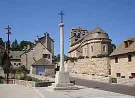 The church square in Fournels | |
.svg.png.webp) Coat of arms | |
Location of Fournels | |
 Fournels  Fournels | |
| Coordinates: 44°49′03″N 3°07′18″E / 44.81750°N 3.1217°E | |
| Country | France |
| Region | Occitania |
| Department | Lozère |
| Arrondissement | Mende |
| Canton | Peyre en Aubrac |
| Intercommunality | Hautes Terres de l'Aubrac |
| Government | |
| • Mayor (2020–2026) | Agnès Bouard[1] |
| Area 1 | 15.76 km2 (6.08 sq mi) |
| Population | 369 |
| • Density | 23/km2 (61/sq mi) |
| Time zone | UTC+01:00 (CET) |
| • Summer (DST) | UTC+02:00 (CEST) |
| INSEE/Postal code | 48064 /48310 |
| Elevation | 909–1,240 m (2,982–4,068 ft) (avg. 943 m or 3,094 ft) |
| 1 French Land Register data, which excludes lakes, ponds, glaciers > 1 km2 (0.386 sq mi or 247 acres) and river estuaries. | |
Fournels (French pronunciation: [fuʁnɛl]; Occitan: Fornèls) is a commune in the Lozère department in southern France.[3]
See also
References
- ↑ "Répertoire national des élus: les maires" (in French). data.gouv.fr, Plateforme ouverte des données publiques françaises. 13 September 2022.
- ↑ "Populations légales 2021". The National Institute of Statistics and Economic Studies. 28 December 2023.
- ↑ INSEE commune file
Wikimedia Commons has media related to Fournels.
This article is issued from Wikipedia. The text is licensed under Creative Commons - Attribution - Sharealike. Additional terms may apply for the media files.