Ash-Shafa
ٱلشَّفَا | |
|---|---|
Village | |
 | |
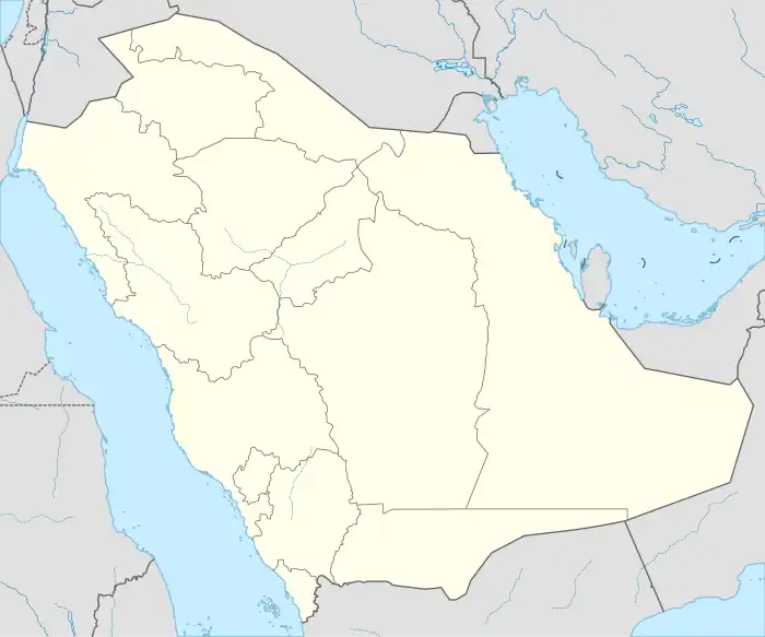 Ash-Shafa Location in Saudi Arabia  Ash-Shafa Ash-Shafa (Near East)  Ash-Shafa Ash-Shafa (West and Central Asia) | |
| Coordinates: 21°04′10″N 40°18′43″E / 21.06944°N 40.31194°E | |
| Country | |
| Province | Makkah Region |
| Time zone | UTC+3 (EAT) |
| • Summer (DST) | UTC+3 (EAT) |
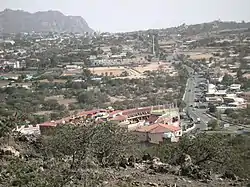
Ash-Shafā (Arabic: ٱلشَّفَا, lit. 'The Edge') is a village in Makkah Province, in western Saudi Arabia.[1][2]
Weather
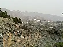
Jabal Daka near Ash-Shafa
| Climate data for Ash Shafa | |||||||||||||
|---|---|---|---|---|---|---|---|---|---|---|---|---|---|
| Month | Jan | Feb | Mar | Apr | May | Jun | Jul | Aug | Sep | Oct | Nov | Dec | Year |
| Mean daily maximum °C (°F) | 17.2 (63.0) |
19.2 (66.6) |
21.6 (70.9) |
24.3 (75.7) |
27.5 (81.5) |
30.4 (86.7) |
29.7 (85.5) |
29.6 (85.3) |
29.6 (85.3) |
24.9 (76.8) |
21.0 (69.8) |
17.9 (64.2) |
24.4 (75.9) |
| Mean daily minimum °C (°F) | 4.2 (39.6) |
5.3 (41.5) |
10.2 (50.4) |
— | 13.4 (56.1) |
16.3 (61.3) |
18.1 (64.6) |
17.7 (63.9) |
15.0 (59.0) |
10.2 (50.4) |
7.8 (46.0) |
4.9 (40.8) |
— |
| Average precipitation mm (inches) | 17 (0.7) |
7 (0.3) |
27 (1.1) |
42 (1.7) |
28 (1.1) |
4 (0.2) |
6 (0.2) |
21 (0.8) |
7 (0.3) |
17 (0.7) |
21 (0.8) |
11 (0.4) |
208 (8.2) |
| Source: [3] | |||||||||||||
See also
References
- ↑ National Geospatial-Intelligence Agency. GeoNames database entry. (search) Accessed 13 May 2011.
- ↑ Cuddihy, Kathy (2001). "18". An A to Z of Places and Things Saudi. London: Stacey International. pp. 174–209. ISBN 1-9009-8840-2.
- ↑ "Climate: Ash Shafa". Climate-Data.org. Retrieved June 2, 2019.
External links
| 1,000,000 and more | |
|---|---|
| 300,000-999,999 | |
| <300,000 | |
Source: cdsi.gov.sa | |
.svg.png.webp)
This article is issued from Wikipedia. The text is licensed under Creative Commons - Attribution - Sharealike. Additional terms may apply for the media files.