Astore
استور | |
|---|---|
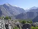
City | |
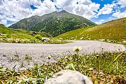    Mountains and hilltops near Astore City | |
 Astore Location in Gilgit-Baltistan 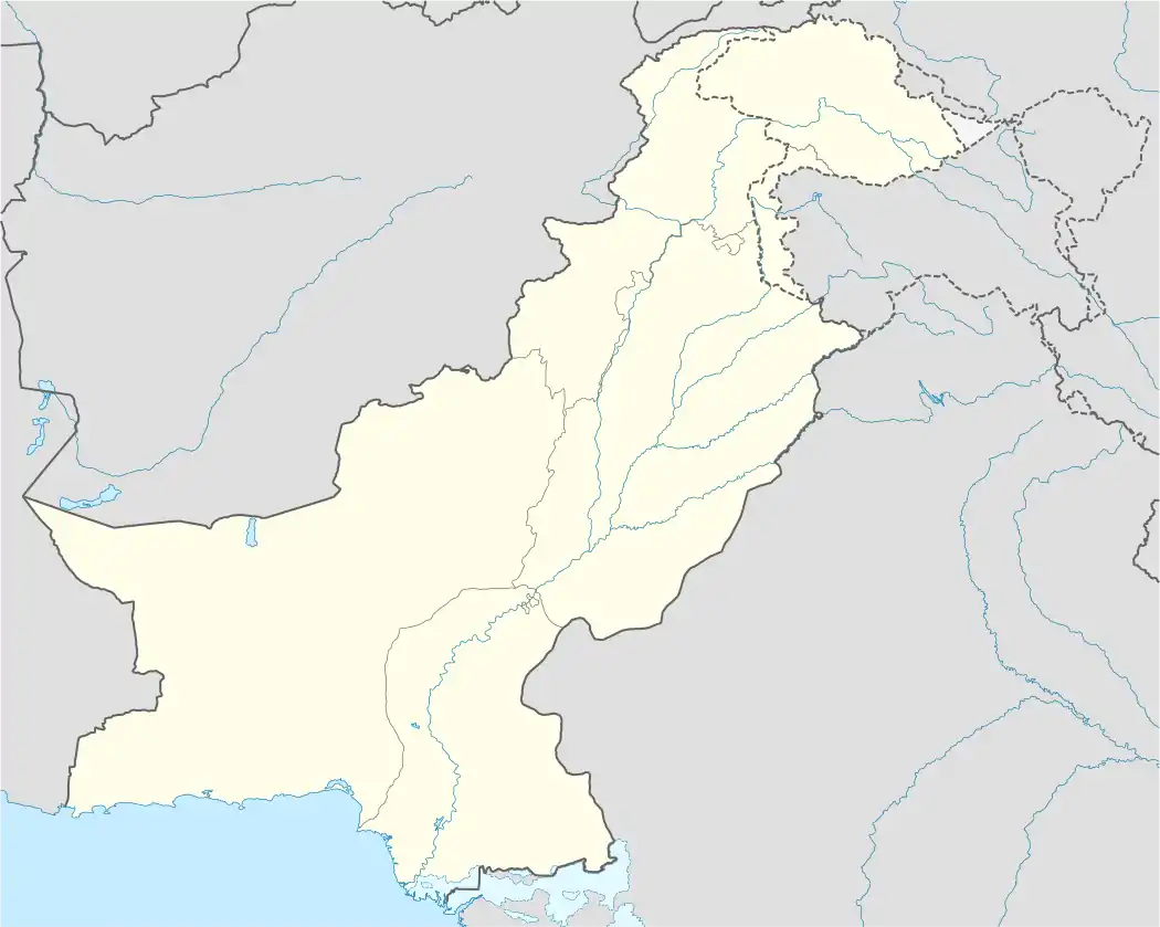 Astore Location in Pakistan | |
| Coordinates: 35°13′N 74°31′E / 35.22°N 74.51°E | |
| Country | |
| Adm. Unit | |
| District | Astore District |
| Elevation | 2,546 m (8,353 ft) |
| Time zone | UTC+5:00 (PKT) |
| Climate | Dsb |
Astore (Urdu: استور) is the capital of Astore District in Gilgit-Baltistan, Pakistan. The city is situated at an altitude of 2,546 metres (8,353 ft).[1]
The major Astore–Burzul Road, which linked Gilgit (in Pakistani-administered Kashmir) to Srinagar (in Indian-administered Kashmir) was indefinitely closed in 1978 following the development of the China–Pakistan Karakoram Highway.[2]
Climate
Astore has a continental climate (Köppen Dsb).
| Climate data for Astore | |||||||||||||
|---|---|---|---|---|---|---|---|---|---|---|---|---|---|
| Month | Jan | Feb | Mar | Apr | May | Jun | Jul | Aug | Sep | Oct | Nov | Dec | Year |
| Record high °C (°F) | 12.3 (54.1) |
15.9 (60.6) |
20.3 (68.5) |
27.2 (81.0) |
30.1 (86.2) |
35.0 (95.0) |
37.0 (98.6) |
34.4 (93.9) |
31.7 (89.1) |
27.7 (81.9) |
21.0 (69.8) |
14.0 (57.2) |
37.0 (98.6) |
| Mean daily maximum °C (°F) | 2.8 (37.0) |
4.3 (39.7) |
8.9 (48.0) |
15.0 (59.0) |
19.9 (67.8) |
24.7 (76.5) |
27.1 (80.8) |
26.9 (80.4) |
23.2 (73.8) |
17.5 (63.5) |
11.4 (52.5) |
5.3 (41.5) |
12.5 (54.5) |
| Mean daily minimum °C (°F) | −7.2 (19.0) |
−5.3 (22.5) |
−0.9 (30.4) |
3.9 (39.0) |
7.6 (45.7) |
11.3 (52.3) |
14.6 (58.3) |
14.6 (58.3) |
10.3 (50.5) |
4.6 (40.3) |
−0.4 (31.3) |
−4.4 (24.1) |
3.2 (37.8) |
| Record low °C (°F) | −17.7 (0.1) |
−21.0 (−5.8) |
−12.0 (10.4) |
−5.0 (23.0) |
−1.7 (28.9) |
1.1 (34.0) |
6.5 (43.7) |
5.6 (42.1) |
−1.1 (30.0) |
−1.7 (28.9) |
−9.0 (15.8) |
−16.1 (3.0) |
−21 (−6) |
| Average rainfall mm (inches) | 42.4 (1.67) |
48.5 (1.91) |
78.2 (3.08) |
87.6 (3.45) |
65.6 (2.58) |
22.8 (0.90) |
22.9 (0.90) |
24.1 (0.95) |
21.9 (0.86) |
23.8 (0.94) |
16.4 (0.65) |
29.1 (1.15) |
401.8 (15.82) |
| Average relative humidity (%) (at 17:00 PST) | 60.3 | 56.6 | 45.5 | 36.8 | 32.6 | 28.8 | 31.8 | 32.8 | 29.6 | 28.6 | 34.3 | 53.5 | 39.3 |
| Source: Pakistan Meteorological Department[3] | |||||||||||||
References
- ↑ "Maps, Weather, and Airports for Astore, Pakistan". www.fallingrain.com. Archived from the original on 3 February 2021. Retrieved 3 February 2021.
- ↑ "Gilgit-Srinagar Road: Govt seeks NA admin's opinion". www.jammu-kashmir.com. Retrieved 10 May 2022.
- ↑ "Astore Climate Data". Pakistan Meteorological Department. Archived from the original on 13 June 2010. Retrieved 11 January 2016.
Wikimedia Commons has media related to Astore (town, Gilgit-Baltistan).
This article is issued from Wikipedia. The text is licensed under Creative Commons - Attribution - Sharealike. Additional terms may apply for the media files.