| Aubetin | |
|---|---|
 | |
 | |
| Location | |
| Country | France |
| Physical characteristics | |
| Source | |
| • location | Les Essarts-le-Vicomte |
| • coordinates | 48°40′05″N 03°32′14″E / 48.66806°N 3.53722°E |
| • elevation | 177 m (581 ft) |
| Mouth | |
• location | Grand Morin |
• coordinates | 48°48′56″N 03°00′26″E / 48.81556°N 3.00722°E |
• elevation | 60 m (200 ft) |
| Length | 61.2 km (38.0 mi) |
| Basin size | 270 km2 (100 sq mi) |
| Discharge | |
| • average | 1.5 m3/s (53 cu ft/s) |
| Basin features | |
| Progression | Grand Morin→ Marne→ Seine→ English Channel |
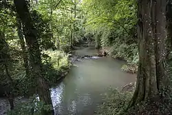
The Aubetin is a 61.2-kilometre (38.0 mi) long river in the Marne and Seine-et-Marne départements, northeastern France.[1] Its source is at Les Essarts-le-Vicomte, 20 kilometres (12 mi) northeast of Nogent-sur-Seine. It flows generally west-northwest. It is a left tributary of the Grand Morin into which it flows at Pommeuse, 5 kilometres (3 mi) west of Coulommiers.
Communes along its course
This list is ordered from source to mouth:
- Marne: Les Essarts-le-Vicomte, Bouchy-Saint-Genest,
- Seine-et-Marne: Louan-Villegruis-Fontaine, Villiers-Saint-Georges, Augers-en-Brie, Cerneux, Courtacon, Beton-Bazoches, Frétoy, Dagny, Amillis, Beautheil, Saints, Mauperthuis, Saint-Augustin, Pommeuse,
References
This article is issued from Wikipedia. The text is licensed under Creative Commons - Attribution - Sharealike. Additional terms may apply for the media files.