Avontuur | |
|---|---|
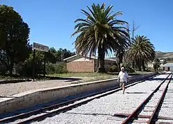 Avontuur's narrow gauge railway station | |
 Avontuur  Avontuur | |
| Coordinates: 33°43′30″S 23°10′08″E / 33.725°S 23.169°E | |
| Country | South Africa |
| Province | Western Cape |
| District | Garden Route |
| Municipality | George |
| Population | |
| • Total | 238 |
| Time zone | UTC+2 (SAST) |
| PO box | 6490 |
| Area code | 044 |
Avontuur is a town situated in the Garden Route District Municipality in the Western Cape province of South Africa.[2] The town is located 13km south-east of Uniondale on an intersection of the R339 and R62 regional routes.
History
The name is Afrikaans for adventure; its origin, however, remains uncertain. The river from which the town takes its name was known in 1778.[3]
See also
References
- ↑ Water Services National Information System - Community Report
- ↑ "Official South African Geographical Names System". Department of Arts and Culture. Archived from the original on 14 March 2012. Retrieved 29 March 2012.
- ↑ "Dictionary of Southern African Place Names (Public Domain)". Human Science Research Council. p. 65.
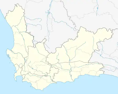
Municipalities and communities of Garden Route District Municipality, Western Cape | ||
|---|---|---|
District seat: George | ||
| Bitou | .svg.png.webp) Garden Route District within South Africa | |
| George | ||
| Hessequa | ||
| Kannaland | ||
| Knysna | ||
| Mossel Bay | ||
| Oudtshoorn | ||
This article is issued from Wikipedia. The text is licensed under Creative Commons - Attribution - Sharealike. Additional terms may apply for the media files.