Bédouès | |
|---|---|
Part of Bédouès-Cocurès | |
 A general view from the promontory of the Collegiate church of Bédouès | |
.svg.png.webp) Coat of arms | |
Location of Bédouès | |
 Bédouès  Bédouès | |
| Coordinates: 44°20′31″N 3°36′20″E / 44.3419°N 3.6056°E | |
| Country | France |
| Region | Occitania |
| Department | Lozère |
| Arrondissement | Florac |
| Canton | Saint-Étienne-du-Valdonnez |
| Commune | Bédouès-Cocurès |
| Area 1 | 26.80 km2 (10.35 sq mi) |
| Population (2017)[1] | 281 |
| • Density | 10/km2 (27/sq mi) |
| Time zone | UTC+01:00 (CET) |
| • Summer (DST) | UTC+02:00 (CEST) |
| Postal code | 48400 |
| Elevation | 540–1,170 m (1,770–3,840 ft) (avg. 560 m or 1,840 ft) |
| 1 French Land Register data, which excludes lakes, ponds, glaciers > 1 km2 (0.386 sq mi or 247 acres) and river estuaries. | |
Bédouès (French pronunciation: [bedwɛs]; Occitan: Bedoesc) is a former commune in the Lozère department in southern France. On 1 January 2016, it was merged into the new commune of Bédouès-Cocurès.[2]
Population
|
|
See also
References
Gallery
 Collegiate church
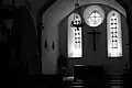 interior
Wikimedia Commons has media related to Bédouès.
This article is issued from Wikipedia. The text is licensed under Creative Commons - Attribution - Sharealike. Additional terms may apply for the media files.