Bad Emstal | |
|---|---|
Location of Bad Emstal within Kassel district 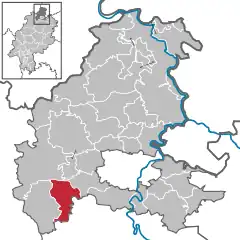 | |
 Bad Emstal 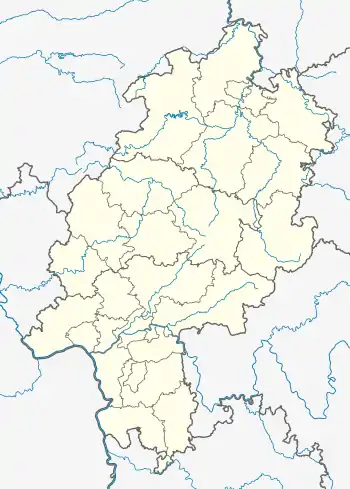 Bad Emstal | |
| Coordinates: 51°14′N 9°15′E / 51.233°N 9.250°E | |
| Country | Germany |
| State | Hesse |
| Admin. region | Kassel |
| District | Kassel |
| Government | |
| • Mayor (2018–24) | Stefan Frankfurth[1] |
| Area | |
| • Total | 38.67 km2 (14.93 sq mi) |
| Elevation | 260 m (850 ft) |
| Population (2022-12-31)[2] | |
| • Total | 5,967 |
| • Density | 150/km2 (400/sq mi) |
| Time zone | UTC+01:00 (CET) |
| • Summer (DST) | UTC+02:00 (CEST) |
| Postal codes | 34308 |
| Dialling codes | 05624 |
| Vehicle registration | KS |
| Website | www.bad-emstal.de |
Bad Emstal is a municipality in the district of Kassel, in Hesse, Germany. It is situated 19 km southwest of Kassel, Germany.
Demographics
Bad Emstal is 20 km in the south-west of the main district city Kassel. The commune is arounded of the national park Habichtswald.
Localities
References
- ↑ "Ergebnisse der letzten Direktwahl aller hessischen Landkreise und Gemeinden" (XLS) (in German). Hessisches Statistisches Landesamt. 5 September 2022.
- ↑ "Bevölkerung in Hessen am 31.12.2022 nach Gemeinden" (XLS) (in German). Hessisches Statistisches Landesamt. June 2023.
Towns and municipalities in Kassel district | ||
|---|---|---|
Wappen des Landkreises Kessel | ||
This article is issued from Wikipedia. The text is licensed under Creative Commons - Attribution - Sharealike. Additional terms may apply for the media files.