Bagnols-les-Bains | |
|---|---|
Part of Mont Lozère et Goulet | |
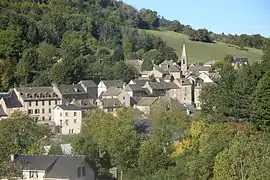 The church and surrounding buildings in Bagnols-les-Bains | |
 Coat of arms | |
Location of Bagnols-les-Bains | |
 Bagnols-les-Bains  Bagnols-les-Bains | |
| Coordinates: 44°30′24″N 3°39′57″E / 44.5067°N 3.6658°E | |
| Country | France |
| Region | Occitania |
| Department | Lozère |
| Arrondissement | Mende |
| Canton | Saint-Étienne-du-Valdonnez |
| Commune | Mont Lozère et Goulet |
| Area 1 | 2.40 km2 (0.93 sq mi) |
| Population (2019)[1] | 218 |
| • Density | 91/km2 (240/sq mi) |
| Time zone | UTC+01:00 (CET) |
| • Summer (DST) | UTC+02:00 (CEST) |
| Postal code | 48190 |
| Elevation | 898–1,145 m (2,946–3,757 ft) (avg. 913 m or 2,995 ft) |
| 1 French Land Register data, which excludes lakes, ponds, glaciers > 1 km2 (0.386 sq mi or 247 acres) and river estuaries. | |
Bagnols-les-Bains (French pronunciation: [baɲɔl le bɛ̃]; Occitan: Banhòls) is a former commune in the Lozère department in southern France. On 1 January 2017, it was merged into the new commune Mont Lozère et Goulet.[2]
Population
|
|
See also
References
- ↑ Téléchargement du fichier d'ensemble des populations légales en 2019, INSEE
- ↑ Arrêté préfectoral 23 May 2016 (in French)
Wikimedia Commons has media related to Bagnols-les-Bains.
This article is issued from Wikipedia. The text is licensed under Creative Commons - Attribution - Sharealike. Additional terms may apply for the media files.