Baie-Atibenne | |
|---|---|
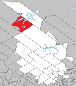 Location within Matawinie RCM. | |
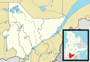 Baie-Atibenne Location in central Quebec. 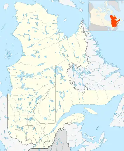 Baie-Atibenne Baie-Atibenne (Quebec) | |
| Coordinates: 47°23′N 74°27′W / 47.383°N 74.450°W[1] | |
| Country | |
| Province | |
| Region | Lanaudière |
| RCM | Matawinie |
| Constituted | March 13, 1986 |
| Government | |
| • Federal riding | Joliette |
| • Prov. riding | Bertrand |
| Area | |
| • Total | 642.54 km2 (248.09 sq mi) |
| • Land | 535.69 km2 (206.83 sq mi) |
| Population (2011)[3] | |
| • Total | 0 |
| • Density | 0.0/km2 (0/sq mi) |
| • Pop 2006-2011 | |
| • Dwellings | 0 |
| Time zone | UTC−5 (EST) |
| • Summer (DST) | UTC−4 (EDT) |
| Highways | No major routes |
Baie-Atibenne is an unorganized territory in the Lanaudière region of Quebec, Canada, part of the Matawinie Regional County Municipality.
See also
References
- ↑ "Banque de noms de lieux du Québec: Reference number 149697". toponymie.gouv.qc.ca (in French). Commission de toponymie du Québec.
- 1 2 "Répertoire des municipalités: Geographic code 62920". www.mamh.gouv.qc.ca (in French). Ministère des Affaires municipales et de l'Habitation.
- 1 2 Statistics Canada 2011 Census - Baie-Atibenne census profile
Adjacent Municipal Subdivisions | |
|---|---|
| Municipalities | |
|---|---|
| Parishes | |
| Unorganized Territories | |
| |
This article is issued from Wikipedia. The text is licensed under Creative Commons - Attribution - Sharealike. Additional terms may apply for the media files.