Bakonyszentlászló | |
|---|---|
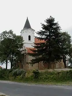 Protestant church | |
 Flag  Coat of arms | |
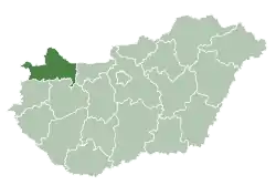
 Bakonyszentlászló Location of Bakonyszentlászló | |
| Coordinates: 47°23′15″N 17°48′03″E / 47.38748°N 17.80072°E | |
| Country | |
| County | Győr-Moson-Sopron |
| Area | |
| • Total | 38.51 km2 (14.87 sq mi) |
| Population (2004) | |
| • Total | 1,905 |
| • Density | 49.46/km2 (128.1/sq mi) |
| Time zone | UTC+1 (CET) |
| • Summer (DST) | UTC+2 (CEST) |
| Postal code | 8431 |
| Area code | 88 |
| Website | https://bakonyszentlaszlo.hu/ |
Bakonyszentlászló is a village in Győr-Moson-Sopron county, Hungary.
In the 19th and 20th centuries, a small Jewish community lived in the village, in 1880 30 Jews lived in the village,[1] most of whom were murdered in the Holocaust.[2] The community had a Jewish cemetery.[3]
References
External links
- Street map (in Hungarian)
| Town (1) |
| |
|---|---|---|
| Villages (16) | ||
This article is issued from Wikipedia. The text is licensed under Creative Commons - Attribution - Sharealike. Additional terms may apply for the media files.