Bayac | |
|---|---|
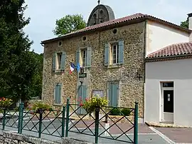 The town hall in Bayac | |
Location of Bayac | |
 Bayac  Bayac | |
| Coordinates: 44°48′16″N 0°43′37″E / 44.8044°N 0.7269°E | |
| Country | France |
| Region | Nouvelle-Aquitaine |
| Department | Dordogne |
| Arrondissement | Bergerac |
| Canton | Lalinde |
| Government | |
| • Mayor (2020–2026) | Annick Carot[1] |
| Area 1 | 10.23 km2 (3.95 sq mi) |
| Population | 357 |
| • Density | 35/km2 (90/sq mi) |
| Time zone | UTC+01:00 (CET) |
| • Summer (DST) | UTC+02:00 (CEST) |
| INSEE/Postal code | 24027 /24150 |
| Elevation | 42–173 m (138–568 ft) (avg. 53 m or 174 ft) |
| 1 French Land Register data, which excludes lakes, ponds, glaciers > 1 km2 (0.386 sq mi or 247 acres) and river estuaries. | |
Bayac (French pronunciation: [bajak]; Occitan: Baiac) is a commune in the Dordogne department in southwestern France.
Population
| Year | Pop. | ±% p.a. |
|---|---|---|
| 1968 | 348 | — |
| 1975 | 308 | −1.73% |
| 1982 | 304 | −0.19% |
| 1990 | 328 | +0.95% |
| 1999 | 326 | −0.07% |
| 2009 | 359 | +0.97% |
| 2014 | 348 | −0.62% |
| 2020 | 358 | +0.47% |
| Source: INSEE[3] | ||
See also
- Communes of the Dordogne department
- Château de Bayac
- Gravettian, archaeological industry of the European Upper Paleolithic; the type-site, La Gravette, is near Bayac
References
- ↑ "Répertoire national des élus: les maires" (in French). data.gouv.fr, Plateforme ouverte des données publiques françaises. 13 September 2022.
- ↑ "Populations légales 2021". The National Institute of Statistics and Economic Studies. 28 December 2023.
- ↑ Population en historique depuis 1968, INSEE
Wikimedia Commons has media related to Bayac.
This article is issued from Wikipedia. The text is licensed under Creative Commons - Attribution - Sharealike. Additional terms may apply for the media files.