| Bayerbacher Bach | |
|---|---|
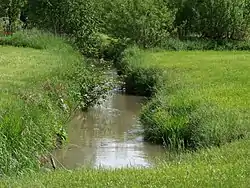 Bayerbacher Bach near Hofkirchen | |
| Location | |
| Country | Germany |
| State | Bavaria |
| Physical characteristics | |
| Source | |
| • location | near Paindlkofen |
| Mouth | |
• location | Kleine Laber near Habelsbach |
• coordinates | 48°48′18″N 12°18′54″E / 48.8051°N 12.3149°E |
| Length | 16.36 km (10.17 mi) [1] |
| Basin size | 75.09 km2 (28.99 sq mi) [1] |
| Discharge | |
| • average | ±0.072 m3/s (2.5 cu ft/s) |
| Basin features | |
| Progression | Kleine Laber→ Große Laber→ Danube→ Black Sea |
The Bayerbacher Bach or Bayerbach is a stream in Bavaria, Germany. It is a tributary of the Kleine Laber in Lower Bavaria.
Course
From its source in the Landshut district near Paindlkofen, a district of the municipality Ergoldsbach, the Bayerbacher Bach mostly flows in the north direction. Among others the stream runs through Feuchten, Bayerbach and Greilsberg.
Then it enters the district Straubing-Bogen. Finally it reaches the municipality of Laberweinting. There, near Habelsbach, the Bayerbacher Bach issues into the Kleine Laber.
Tributaries
- Wildbach (right)
- Mühlbach (right)
- Gerabach (right)
- Stockaer Bach (left)
- Hillbach (right)
- Oberellenbach (left)
- Asbach (right)
- Ellenbach (right)
- Haadersbach (right)
See also
References
- 1 2 Complete table of the Bavarian Waterbody Register by the Bavarian State Office for the Environment (xls, 10.3 MB)
External links
- Verzeichnis der Bach- und Flussgebiete in Bayern – Flussgebiet Naab bis Isar (PDF; 2,8 MB) p. 70
This article is issued from Wikipedia. The text is licensed under Creative Commons - Attribution - Sharealike. Additional terms may apply for the media files.