Beckum | |
|---|---|
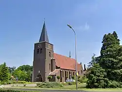 The Roman Catholic St. Blasius Church | |
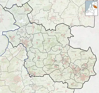 Beckum Location in the Netherlands  Beckum Beckum (Netherlands) | |
| Coordinates: 52°12′38″N 6°44′29″E / 52.21056°N 6.74139°E | |
| Country | Netherlands |
| Province | Overijssel |
| Municipality | Hengelo |
| Area | |
| • Total | 3.93 km2 (1.52 sq mi) |
| Elevation | 24 m (79 ft) |
| Population (2021)[1] | |
| • Total | 175 |
| • Density | 45/km2 (120/sq mi) |
| Time zone | UTC+1 (CET) |
| • Summer (DST) | UTC+2 (CEST) |
| Postal code | 7482[1] |
| Dialing code | 053 |
| Website | www.beckum.nl |
Beckum is a small village 3 km (2 mi) south of Hengelo, Netherlands. The village lies in the municipality of Hengelo, between Hengelo and Haaksbergen.
It was first mentioned in 1268 as Beckem, and might mean "settlement along a brook".[3] In 1840, it was home to 304 people. At the centre of the village is the Roman Catholic Church of St. Blasius, built in 1938.[4] The postal authorities have placed it under Haaksbergen.[5]
References
- 1 2 3 "Kerncijfers wijken en buurten 2021". Central Bureau of Statistics. Retrieved 18 March 2022.
- ↑ "Postcodetool for 7482AA". Actueel Hoogtebestand Nederland (in Dutch). Het Waterschapshuis. Retrieved 18 March 2022.
- ↑ "Beckum". Etymologiebank (in Dutch). Retrieved 18 March 2022.
- ↑ "Beckum". Plaatsengids (in Dutch). Retrieved 18 March 2022.
- ↑ "Postcode 7482 in Haaksbergen". Postcode bij adres (in Dutch). Retrieved 18 March 2022.
External links
- http://www.beckum.nl (Dutch)
This article is issued from Wikipedia. The text is licensed under Creative Commons - Attribution - Sharealike. Additional terms may apply for the media files.