Beratsimanana | |
|---|---|
 Beratsimanana Location in Madagascar | |
| Coordinates: 16°53′S 46°53′E / 16.883°S 46.883°E | |
| Country | |
| Region | Betsiboka |
| District | Maevatanana |
| Elevation | 54 m (177 ft) |
| Population (2001)[2] | |
| • Total | 8,000 |
| Time zone | UTC3 (EAT) |
Beratsimanana is a town and commune (Malagasy: kaominina) in Madagascar. It belongs to the district of Maevatanana, which is a part of Betsiboka Region. The population of the commune was estimated to be approximately 8,000 in 2001 commune census.[2]
Only primary schooling is available. The majority 80% of the population of the commune are farmers, while an additional 20% receives their livelihood from raising livestock. The most important crops are rice and peanuts, while other important agricultural products are sweet potatoes and tobacco.[2]
References and notes
- ↑ Estimated based on DEM data from Shuttle Radar Topography Mission
- 1 2 3 "ILO census data". Cornell University. 2002. Retrieved 2008-03-05.
Capital: Maevatanana | ||
| Kandreho (7) - 411 | 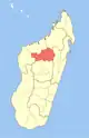 | |
| Maevatanana (20) - 412 | ||
| Tsaratanana (13) - 421 | ||
3 districts; 32 communes | ||
16°53′S 46°53′E / 16.883°S 46.883°E
This article is issued from Wikipedia. The text is licensed under Creative Commons - Attribution - Sharealike. Additional terms may apply for the media files.