Bomba | |
|---|---|
| Comune di Bomba | |
 | |
Location of Bomba | |
 Bomba Location of Bomba in Italy 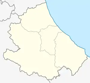 Bomba Bomba (Abruzzo) | |
| Coordinates: 42°2′N 14°22′E / 42.033°N 14.367°E | |
| Country | Italy |
| Region | Abruzzo |
| Province | Chieti (CH) |
| Frazioni | Sambuceto, Vallecupa |
| Government | |
| • Mayor | Raffaele Nasuti |
| Area | |
| • Total | 17.26 km2 (6.66 sq mi) |
| Elevation | 424 m (1,391 ft) |
| Population (30 April 2017)[2] | |
| • Total | 790 |
| • Density | 46/km2 (120/sq mi) |
| Demonym | Bombesi |
| Time zone | UTC+1 (CET) |
| • Summer (DST) | UTC+2 (CEST) |
| Postal code | 66042 |
| Dialing code | 0872 |
| Patron saint | St. Donatus |
| Saint day | 7 August |
| Website | Official website |
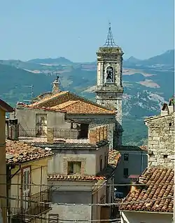
Bomba (Abruzzese: Bòmme) is a comune and town in the province of Chieti in the Abruzzo region of Italy. Silvio Spaventa and Bertrando Spaventa were born in Bomba.
Main sights
- Parish church of Santa Maria del Popolo
- Sanctuary of San Mauro Abate
- Church of San Mauro fuori le mura
- Ethnographic Museum
- Remains of the urban walls and gates (c. 12th century)
- Archaeological site of Monte Pallano, perhaps including remains of the ancient Frentani town of Pallanum (6th century BC)
References
- ↑ "Superficie di Comuni Province e Regioni italiane al 9 ottobre 2011". Italian National Institute of Statistics. Retrieved 16 March 2019.
- ↑ All demographics and other statistics from the Italian statistical institute (Istat)
This article is issued from Wikipedia. The text is licensed under Creative Commons - Attribution - Sharealike. Additional terms may apply for the media files.