Borovets
Боровец | |
|---|---|
Village | |
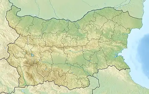 Borovets Location of Borovets | |
| Coordinates: 42°7′N 23°0′E / 42.117°N 23.000°E | |
| Country | |
| Province | Kyustendil Province |
| Municipality | Kocherinovo |
| Area | |
| • Total | 5.946 km2 (2.296 sq mi) |
| Elevation | 446 m (1,463 ft) |
| Population (2013)[1] | |
| • Total | 94 |
| Time zone | UTC+2 (EET) |
| • Summer (DST) | UTC+3 (EEST) |
Borovets (Bulgarian: Боровец) is a village in Kocherinovo Municipality, Kyustendil Province, south-western Bulgaria. As of 2013 it has 94 inhabitants.[1] It is situated close to the right bank of the Struma River at 2 km to the north-west of the municipal centre Kocherinovo.
Citations
- 1 2 "Borovets". Guide Bulgaria. Archived from the original on 6 March 2016. Retrieved 5 July 2018.
Capital: Kocherinovo | ||
| Villages |  | |
| Landmarks | ||
| Culture | ||
| Notable people |
| |
42°07′00″N 23°00′00″E / 42.1167°N 23.0000°E
This article is issued from Wikipedia. The text is licensed under Creative Commons - Attribution - Sharealike. Additional terms may apply for the media files.