Bottovo | |
|---|---|
Municipality | |
 | |
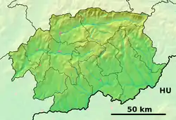 Bottovo Location of Bottovo in the Banská Bystrica Region 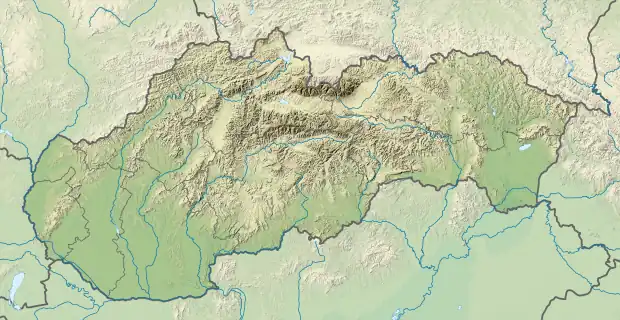 Bottovo Location of Bottovo in Slovakia | |
| Coordinates: 48°19′47″N 20°09′00″E / 48.32972°N 20.15000°E | |
| Country | |
| Region | Banská Bystrica |
| District | Rimavská Sobota |
| First mentioned | 1926 |
| Area | |
| • Total | 10.788919 km2 (4.165625 sq mi) |
| Elevation | 196 m (643 ft) |
| Population (2011) | |
| • Total | 204 |
| • Density | 19/km2 (49/sq mi) |
| Time zone | UTC+1 (CET) |
| • Summer (DST) | UTC+2 (CEST) |
| Postal code | 980 41 (pošta Dubovec) |
| Area code | +421-47 |
| Car plate | RS |
| Website | www |
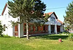
Bottovo (Hungarian: Bottovó) is a village and municipality in the Rimavská Sobota District of the Banská Bystrica Region of Slovakia. In the village is gym hall, foodstuff store, public library and a football pitch.
External links
 Media related to Bottovo at Wikimedia Commons
- Official website

- https://web.archive.org/web/20071116010355/http://www.statistics.sk/mosmis/eng/run.html
- http://www.e-obce.sk/obec/bottovo/bottovo.html
This article is issued from Wikipedia. The text is licensed under Creative Commons - Attribution - Sharealike. Additional terms may apply for the media files.