| Bouble | |
|---|---|
 | |
  | |
| Location | |
| Country | France |
| Physical characteristics | |
| Source | |
| • location | Gouttières |
| • coordinates | 46°04′52″N 02°47′26″E / 46.08111°N 2.79056°E |
| • elevation | 620 m (2,030 ft) |
| Mouth | |
• location | Sioule |
• coordinates | 46°17′02″N 03°16′28″E / 46.28389°N 3.27444°E |
• elevation | 235 m (771 ft) |
| Length | 65.4 km (40.6 mi) |
| Basin size | 555 km2 (214 sq mi) |
| Discharge | |
| • average | 3.97 m3/s (140 cu ft/s) |
| Basin features | |
| Progression | Sioule→ Allier→ Loire→ Atlantic Ocean |
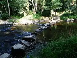
The Bouble (French pronunciation: [bubl]) is a 65.4-kilometre (40.6 mi) long river in the Allier and Puy-de-Dôme departments in south central France.[1] Its source is at Gouttières. It flows generally northeast. It is a left tributary of the Sioule into which it flows between Saint-Pourçain-sur-Sioule and Bayet.
Departments and communes along its course
This list is ordered from source to mouth:
- Puy-de-Dôme: Gouttières, Teilhet, Youx, Saint-Éloy-les-Mines, Moureuille, Durmignat
- Allier: Échassières
- Puy-de-Dôme: Lapeyrouse
- Allier: Louroux-de-Bouble, Vernusse, Chirat-l'Église, Target, Monestier, Bellenaves, Chantelle, Deneuille-lès-Chantelle, Fourilles, Chareil-Cintrat, Bayet, Saint-Pourçain-sur-Sioule
References
This article is issued from Wikipedia. The text is licensed under Creative Commons - Attribution - Sharealike. Additional terms may apply for the media files.