Bourneville | |
|---|---|
Part of Bourneville-Sainte-Croix | |
 | |
Location of Bourneville | |
 Bourneville  Bourneville | |
| Coordinates: 49°23′30″N 0°37′18″E / 49.3917°N 0.6217°E | |
| Country | France |
| Region | Normandy |
| Department | Eure |
| Arrondissement | Bernay |
| Canton | Bourg-Achard |
| Commune | Bourneville-Sainte-Croix |
| Area 1 | 11.01 km2 (4.25 sq mi) |
| Population (2019)[1] | 1,029 |
| • Density | 93/km2 (240/sq mi) |
| Time zone | UTC+01:00 (CET) |
| • Summer (DST) | UTC+02:00 (CEST) |
| Postal code | 27500 |
| Elevation | 63–137 m (207–449 ft) (avg. 180 m or 590 ft) |
| 1 French Land Register data, which excludes lakes, ponds, glaciers > 1 km2 (0.386 sq mi or 247 acres) and river estuaries. | |
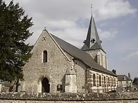
Bourneville (French pronunciation: [buʁnəvil]) is a former commune in the Eure department in Normandy in northern France. On 1 January 2016, it was merged into the new commune of Bourneville-Sainte-Croix.[2]
Population
| Year | Pop. | ±% |
|---|---|---|
| 1962 | 417 | — |
| 1968 | 461 | +10.6% |
| 1975 | 591 | +28.2% |
| 1982 | 680 | +15.1% |
| 1990 | 691 | +1.6% |
| 1999 | 736 | +6.5% |
| 2008 | 854 | +16.0% |
See also
References
- ↑ Téléchargement du fichier d'ensemble des populations légales en 2019, INSEE
- ↑ Arrêté préfectoral 23 November 2015 (in French)
Wikimedia Commons has media related to Bourneville.
This article is issued from Wikipedia. The text is licensed under Creative Commons - Attribution - Sharealike. Additional terms may apply for the media files.