Braine-le-Château | |
|---|---|
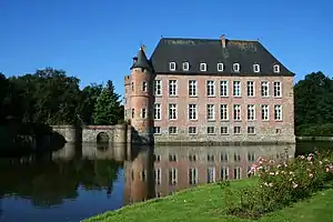 Braine-le-Château: the castle | |
 Flag  Coat of arms | |
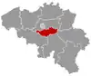
Location of Braine-le-Château | |
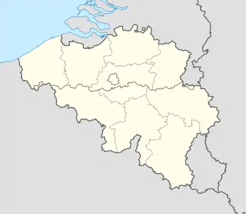 Braine-le-Château Location in Belgium
The municipality of Braine-le-Château in Walloon Brabant 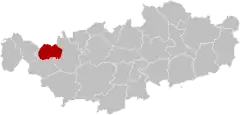 | |
| Coordinates: 50°41′N 04°16′E / 50.683°N 4.267°E | |
| Country | |
| Community | French Community |
| Region | Wallonia |
| Province | Walloon Brabant |
| Arrondissement | Nivelles |
| Government | |
| • Mayor | Nicolas Tamigniau (RB) |
| • Governing party/ies | Renouveau Brainois (RB) |
| Area | |
| • Total | 22.75 km2 (8.78 sq mi) |
| Population (2018-01-01)[1] | |
| • Total | 10,447 |
| • Density | 460/km2 (1,200/sq mi) |
| Postal codes | 1440 |
| NIS code | 25015 |
| Area codes | 02 |
| Website | www.braine-le-chateau.be |
Braine-le-Château (French pronunciation: [bʁɛn lə ʃato] ⓘ; Walloon: Brinne-Tchestea; Dutch: Kasteelbrakel, Dutch pronunciation: [kɑˈsteːlˌbraːkəl]) is a municipality of Wallonia located in the Belgian province of Walloon Brabant.
On January 1, 2006, Braine-le-Château had a total population of 9,446. The total area is 22.70 km² which gives a population density of 416 inhabitants per km².
The municipality consists of the following districts: Braine-le-Château and Wauthier-Braine, which were municipalities of their own until 1977.
Braine-le-Château is a medieval village in which remain many buildings from the Middle Ages. Among them are the pillory (1521), the village mill (c. 1200) and the Maison du Bailli (c. 1535).
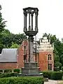 the pillory and the Bailli House
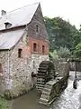 Moulin banal (mill)
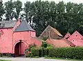 The Binchfort farm (16th century)
References
- ↑ "Wettelijke Bevolking per gemeente op 1 januari 2018". Statbel. Retrieved 9 March 2019.
External links
 Media related to Braine-le-Château at Wikimedia Commons
- Official website
Places adjacent to Braine-le-Château | ||||||||||||||||
|---|---|---|---|---|---|---|---|---|---|---|---|---|---|---|---|---|
| ||||||||||||||||
This article is issued from Wikipedia. The text is licensed under Creative Commons - Attribution - Sharealike. Additional terms may apply for the media files.