Broek | |
|---|---|
Hamlet | |
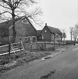 Farm in Broek | |
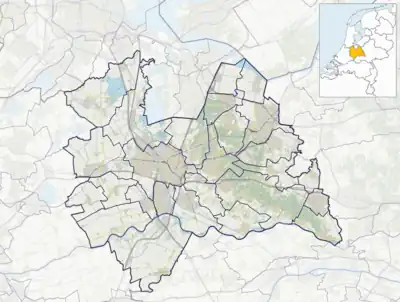 Broek Location in the Netherlands  Broek Broek (Netherlands) | |
| Coordinates: 51°55′58″N 4°58′04″E / 51.9327°N 4.9677°E | |
| Country | Netherlands |
| Province | Utrecht |
| Municipality | Vijfheerenlanden |
| Area | |
| • Total | 10.18 km2 (3.93 sq mi) |
| Population (2021)[1] | |
| • Total | 425 |
| • Density | 42/km2 (110/sq mi) |
| Time zone | UTC+1 (CET) |
| • Summer (DST) | UTC+2 (CEST) |
| Postal code | 4231[1] |
| Dialing code | 0183 |
Broek is a hamlet in the Dutch province of Utrecht. It is a part of the municipality of Vijfheerenlanden, and lies about 11 km north of Gorinchem.
Broek has no place name signs,[2] and the postal authorities have placed it under Meerkerk.[3] In 1840, it was home to 293 people. A part of the hamlet has been placed under Ameide and consists of about 10 houses.[2]
References
- 1 2 3 "Kerncijfers wijken en buurten 2021". Central Bureau of Statistics. Retrieved 27 March 2022.
- 1 2 "Broek (Meerkerk)". Plaatsengids (in Dutch). Retrieved 27 March 2022.
- ↑ "Postcode 4231 in Meerkerk". Postcode bij adres (in Dutch). Retrieved 27 March 2022.
This article is issued from Wikipedia. The text is licensed under Creative Commons - Attribution - Sharealike. Additional terms may apply for the media files.