Burgervlotbrug | |
|---|---|
Hamlet | |
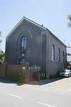 Former Mennonite church | |
 Burgervlotbrug Location in the Netherlands 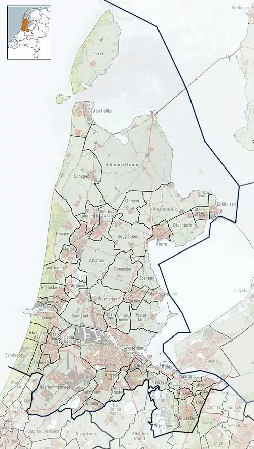 Burgervlotbrug Location in the province of North Holland in the Netherlands | |
| Coordinates: 52°45′11″N 4°40′54″E / 52.75306°N 4.68167°E | |
| Country | Netherlands |
| Province | North Holland |
| Municipality | Schagen |
| Area | |
| • Total | 4.13 km2 (1.59 sq mi) |
| Elevation | 1.0 m (3.3 ft) |
| Population (2021)[1] | |
| • Total | 185 |
| • Density | 45/km2 (120/sq mi) |
| Time zone | UTC+1 (CET) |
| • Summer (DST) | UTC+2 (CEST) |
| Postal code | 1754[1] |
| Dialing code | 0226 |
Burgervlotbrug is a hamlet in the Dutch province of North Holland. It is a part of the municipality of Schagen, and lies about 15 km north of Alkmaar.
Burgervlotbrug is considered part of Burgerbrug. It has place name signs.[3]
The village is named after a floating bridge ("vlotbrug" in Dutch) in the Noordhollandsch Kanaal. The bridge is still in operation. There is a little Mennonite church from 1869 which is nowadays a residential home.[3]
References
- 1 2 3 "Kerncijfers wijken en buurten 2021". Central Bureau of Statistics. Retrieved 1 May 2022.
- ↑ "Postcodetool for 1754EB". Actueel Hoogtebestand Nederland (in Dutch). Het Waterschapshuis. Retrieved 1 May 2022.
- 1 2 "Burgervlotbrug". Plaatsengids (in Dutch). Retrieved 1 May 2022.
Wikimedia Commons has media related to Burgervlotbrug.
This article is issued from Wikipedia. The text is licensed under Creative Commons - Attribution - Sharealike. Additional terms may apply for the media files.