Camaquã | |
|---|---|
| Municipality of Camaquã | |
 Flag  Seal | |
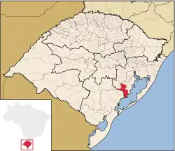 Location within Rio Grande do Sul | |
 Camaquã Location in Brazil | |
| Coordinates: 30°51′S 51°49′W / 30.850°S 51.817°W | |
| Country | |
| State | |
| Government | |
| • Mayor | Ivo de Lima Ferreira |
| Area | |
| • Total | 1,679.556 km2 (648.480 sq mi) |
| Population (2020 [1]) | |
| • Total | 66,478 |
| • Density | 40/km2 (100/sq mi) |
| Time zone | UTC−3 (BRT) |
| HDI (2010) | 0.768 – high[2] |
Camaquã is a municipality in the state of Rio Grande do Sul, Brazil.
The municipality contains part of the 7,993 hectares (19,750 acres) Camaquã State Park, which was created in 1975.[3]
See also
Wikimedia Commons has media related to Camaquã.
References
- ↑ IBGE 2020
- ↑ "Archived copy" (PDF). United Nations Development Programme (UNDP). Archived from the original (PDF) on July 8, 2014. Retrieved August 1, 2013.
{{cite web}}: CS1 maint: archived copy as title (link) - ↑ Parque Estadual do Camaquã (in Portuguese), SEMA: Secretaria do Ambiente e Desenvolvimento Sustentável (RS), retrieved 2017-01-22

This article is issued from Wikipedia. The text is licensed under Creative Commons - Attribution - Sharealike. Additional terms may apply for the media files.