Camp Robin | |
|---|---|
 Camp Robin Location in Madagascar | |
| Coordinates: 20°55′S 47°8′E / 20.917°S 47.133°E | |
| Country | |
| Region | Haute Matsiatra |
| District | Ambohimahasoa |
| Elevation | 1,371 m (4,498 ft) |
| Population (2018) | |
| • Total | 12,803 |
| Time zone | UTC3 (EAT) |
| Postal code | 305 |
Camp Robin is a rural commune in the Central Highlands of Madagascar. It belongs to the district of Ambohimahasoa, which is a part of Haute Matsiatra Region. The population of the commune was estimated to be 12803 in 2018.
Only primary schooling is available. The majority 98% of the population of the commune are farmers. The most important crops are rice and potatoes, while other important agricultural products are peanuts and cassava. Services provide employment for 2% of the population.[2]
Roads
Camp Robin is situated on the National road 7, north of Fianarantsoa.
References
- ↑ Estimated based on DEM data from Shuttle Radar Topography Mission
- ↑ "ILO census data". Cornell University. 2002. Retrieved 2008-05-01.
Capital: Fianarantsoa | ||
| Ambalavao (17) - 303 | 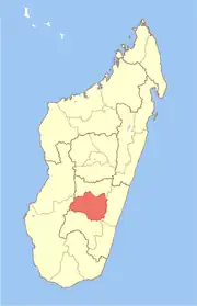 | |
| Ambohimahasoa (17) - 305 | ||
| Fianarantsoa (1) - 301 | ||
| Ikalamavony (8) - 314 | ||
| Isandra (13) - 314 | ||
| Lalangina (13) - 303 | ||
| Vohibato (15) - 305 | ||
Total: 7 districts; 84 communes | ||
20°55′S 47°8′E / 20.917°S 47.133°E
This article is issued from Wikipedia. The text is licensed under Creative Commons - Attribution - Sharealike. Additional terms may apply for the media files.