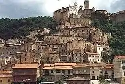
Cantalice | |
|---|---|
| Comune di Cantalice | |
 | |
Location of Cantalice | |
 Cantalice Location of Cantalice in Italy 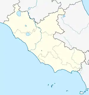 Cantalice Cantalice (Lazio) | |
| Coordinates: 42°28′N 12°54′E / 42.467°N 12.900°E | |
| Country | Italy |
| Region | Lazio |
| Province | Rieti (RI) |
| Frazioni | Capolaterra, Civitella, Collemare, Colli, Cruciano, San Liberato, Santa Margherita |
| Government | |
| • Mayor | Paolo Patacchiola |
| Area | |
| • Total | 37.7 km2 (14.6 sq mi) |
| Elevation | 660 m (2,170 ft) |
| Population (30 April 2008)[2] | |
| • Total | 2,832 |
| • Density | 75/km2 (190/sq mi) |
| Demonym | Cantaliciani |
| Time zone | UTC+1 (CET) |
| • Summer (DST) | UTC+2 (CEST) |
| Postal code | 02014 |
| Dialing code | 0746 |
| Patron saint | San Felice |
| Saint day | May 18 |
| Website | Official website |
Cantalice is a comune (municipality) in the Province of Rieti in the Italian region of Latium, located about 70 kilometres (43 mi) northeast of Rome and about 8 kilometres (5 mi) northeast of Rieti.
References
- ↑ "Superficie di Comuni Province e Regioni italiane al 9 ottobre 2011". Italian National Institute of Statistics. Retrieved 16 March 2019.
- ↑ All demographics and other statistics: Italian statistical institute Istat.
External links
This article is issued from Wikipedia. The text is licensed under Creative Commons - Attribution - Sharealike. Additional terms may apply for the media files.