Cavell, Arkansas | |
|---|---|
 Cavell, Arkansas  Cavell, Arkansas | |
| Coordinates: 35°15′36″N 91°15′39″W / 35.26000°N 91.26083°W | |
| Country | United States |
| State | Arkansas |
| County | Woodruff |
| Elevation | 200 ft (60 m) |
| Time zone | UTC-6 (Central (CST)) |
| • Summer (DST) | UTC-5 (CDT) |
| Area code | 870 |
| GNIS feature ID | 57531[1] |
Cavell is an unincorporated community in Woodruff County, Arkansas, United States.[1] It is west of McCrory, Arkansas and just west of Patterson, Arkansas, though there is no direct road between Cavell and Patterson.[2] It is located off Woodruff County Road 775 at the Old Highway 64 4WD Trail.[3]
References
- 1 2 3 U.S. Geological Survey Geographic Names Information System: Cavell, Arkansas
- ↑ "Cavell, Arkansas". Google Maps. Retrieved October 20, 2022.
- ↑ "Old Highway 64 4WD Trail, Arkansas to Cavell, Arkansas". Google Maps. Retrieved October 20, 2022.
Municipalities and communities of Woodruff County, Arkansas, United States | ||
|---|---|---|
| Cities | 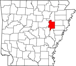 Map of Arkansas highlighting Woodruff County | |
| Towns | ||
| CDP | ||
| Other unincorporated communities | ||
| Ghost town | ||
| Footnotes | ‡This populated place also has portions in an adjacent county or counties | |
This article is issued from Wikipedia. The text is licensed under Creative Commons - Attribution - Sharealike. Additional terms may apply for the media files.