Chamaca
Ch'amaka | |
|---|---|
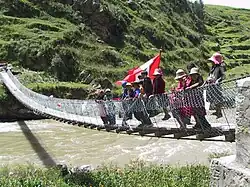 Collpatomaico footbridge | |
| Country | |
| Region | Cusco |
| Province | Chumbivilcas |
| Founded | January 2, 1857 |
| Capital | Chamaca |
| Government | |
| • Mayor | Victor Rolando Abarca Peña |
| Area | |
| • Total | 674.19 km2 (260.31 sq mi) |
| Elevation | 3,754 m (12,316 ft) |
| Population | |
| • Total | 6,993 |
| • Density | 10/km2 (27/sq mi) |
| Time zone | UTC-5 (PET) |
| UBIGEO | 080703 |
Chamaca (Quechua: Chamaqa; Aymara: Ch'amaka, meaning, dark or darkness) is one of eight districts of the Chumbivilcas Province in Peru.[1]
Geography
One of the highest peaks of the district is Qala Qala at approximately 4,400 m (14,400 ft). Other mountains are listed below:[2]
- Allqu Wasi
- Ch'iyar Jaqhi
- Hatun Taruka Marka
- Kuntur Marka
- Kuntur Wasi
- Llama Kancha
- Mulli Pata
- Ñawiyuq
- Pampa
- Pichqa Pukyu
- Pinqulluni
- Puma Suyru
- Qachu
- Quyllur Urqu
- Saywa
- Surimana
- Taruka Marka
- Tintaya
- T'uqra
- Wachuna
- Waylla Punchu
- Willa Qawi
- Willkani
- Wisalla
- Yana Qaqa
Ethnic groups
The people in the district are mainly indigenous citizens of Quechua descent. Quechua is the language which the majority of the population (93.64%) learnt to speak in childhood, 6.12% of the residents started speaking using the Spanish language (2007 Peru Census).[3]
See also
References
- ↑ (in Spanish) Instituto Nacional de Estadística e Informática. Banco de Información Distrital Archived April 23, 2008, at the Wayback Machine. Retrieved April 11, 2008.
- ↑ escale.minedu.gob.pe/ UGEL map Chumbivilcas Province (Cusco Region)
- ↑ inei.gob.pe Archived January 27, 2013, at the Wayback Machine INEI, Peru, Censos Nacionales 2007, Frequencias: Preguntas de Población: Idioma o lengua con el que aprendió hablar (in Spanish)
| |
|---|---|
| Acomayo | |
| Anta | |
| Calca | |
| Canas | |
| Canchis | |
| Chumbivilcas | |
| Cusco | |
| Espinar | |
| La Convención | |
| Paruro | |
| Paucartambo | |
| Quispicanchi | |
| Urubamba | |
This article is issued from Wikipedia. The text is licensed under Creative Commons - Attribution - Sharealike. Additional terms may apply for the media files.