Champdray | |
|---|---|
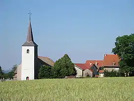 The church and surroundings in Champdray | |
Location of Champdray | |
 Champdray  Champdray | |
| Coordinates: 48°08′10″N 6°45′13″E / 48.1361°N 6.7536°E | |
| Country | France |
| Region | Grand Est |
| Department | Vosges |
| Arrondissement | Saint-Dié-des-Vosges |
| Canton | Bruyères |
| Intercommunality | CC Gérardmer Hautes Vosges |
| Government | |
| • Mayor (2020–2026) | Élisabeth Klipfel[1] |
| Area 1 | 9.49 km2 (3.66 sq mi) |
| Population | 190 |
| • Density | 20/km2 (52/sq mi) |
| Time zone | UTC+01:00 (CET) |
| • Summer (DST) | UTC+02:00 (CEST) |
| INSEE/Postal code | 88085 /88640 |
| Elevation | 589–809 m (1,932–2,654 ft) (avg. 712 m or 2,336 ft) |
| 1 French Land Register data, which excludes lakes, ponds, glaciers > 1 km2 (0.386 sq mi or 247 acres) and river estuaries. | |
Champdray (French pronunciation: [ʃɑ̃dʁɛ] ⓘ) is a commune in the Vosges department in Grand Est in northeastern France.[3] It lies 23 km east of Épinal, the department capital.[4]
See also
References
- ↑ "Répertoire national des élus: les maires" (in French). data.gouv.fr, Plateforme ouverte des données publiques françaises. 13 September 2022.
- ↑ "Populations légales 2021". The National Institute of Statistics and Economic Studies. 28 December 2023.
- ↑ Commune de Champdray (88085), INSEE
- ↑ Quelques villes proches de Champdray, villorama.com
Wikimedia Commons has media related to Champdray.
This article is issued from Wikipedia. The text is licensed under Creative Commons - Attribution - Sharealike. Additional terms may apply for the media files.