Chong Kal
ចុងកាល Chong Khan | |
|---|---|
 Chong Kal Location in Cambodia | |
| Coordinates: 14°10′N 103°35′E / 14.167°N 103.583°E | |
| Country | |
| Province | Oddar Meanchey |
| Elevation | 32 m (105 ft) |
| Time zone | +7 |
| Geocode | 2203 |
Chong Kal District is a district in Oddar Meancheay province in northern Cambodia. According to the 1998 census of Cambodia, it had a population of 18,843.[1]
Administration
The following table shows the villages of Chong Kal district by commune.
| Khum (Communes) | Phum (Villages) |
|---|---|
| Cheung Tien | Cheung Tien, Srae Prang, Kouk Pongro, Ta Nouk, Kouk Trang, Chhkae Sraeng, Kouk Reang |
| Chong Kal | Chong Kal, Kouk Voat, Ka, Prey Thum, Chhork, Srama, Banteay Chas, Ah Toa, Bat Thkao, Banteay Thmey |
| Krasang | Khnar, Chhuk, Kouk Spean, Koul, Chek Kbour, Kouk Samrech, Kouk Thnong, Rolum Veaeng, Kouk Bantoat Baoh, Kouk Thom |
| Pongro | Pongro, Ampil, Ta Paen, Kandaol Dom, Banteay Choar, Srah Kaev, Kouk Sangkae, Prey Nokor, |
References
- ↑ "General Population Census of Cambodia 1998, Final Census Results" (PDF). National Institute of Statistics, Ministry of Planning, Cambodia. August 2002. Retrieved 2010-11-25. See page 269.
Capital: Samraong | ||
| Districts | 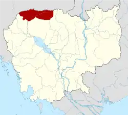 | |
| Autonomous municipality |
| ||
|---|---|---|---|
| Provinces | |||
14°10′N 103°35′E / 14.167°N 103.583°E
This article is issued from Wikipedia. The text is licensed under Creative Commons - Attribution - Sharealike. Additional terms may apply for the media files.