Chum Kiri
ស្រុកជុំគីរី | |
|---|---|
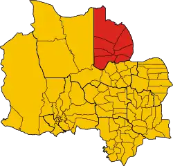 District location in Kampot Province | |
| Coordinates: 10°51′N 104°24′E / 10.850°N 104.400°E | |
| Country | |
| Province | Kampot |
| Communes | 7 |
| Villages | 37 |
| Population (1998)[1] | |
| • Total | 39,320 |
| Time zone | +7 |
| Geocode | 0704 |
Chum Kiri District (Khmer: ស្រុកជុំគីរី) is a district located in Kampot Province, in southern Cambodia.
References
- ↑ General Population Census of Cambodia, 1998: Village Gazetteer. National Institute of Statistics. February 2000. pp. 214–215.
Capital: Kampot | ||
| Districts | 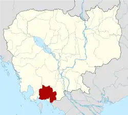 | |
| Places | ||
| Autonomous municipality |
| ||
|---|---|---|---|
| Provinces | |||
10°51′N 104°24′E / 10.850°N 104.400°E
This article is issued from Wikipedia. The text is licensed under Creative Commons - Attribution - Sharealike. Additional terms may apply for the media files.