| Chungju Dam | |
|---|---|
 | |
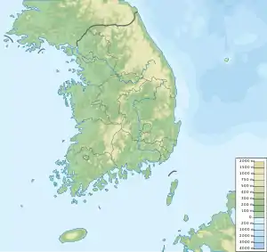 Location of Chungju Dam in South Korea | |
| Country | South Korea |
| Location | Chungju |
| Coordinates | 37°00′22″N 127°59′33″E / 37.00611°N 127.99250°E |
| Status | Operational |
| Construction began | 1978 |
| Opening date | 1985 |
| Owner(s) | Korea Water Resources Corporation |
| Dam and spillways | |
| Type of dam | Gravity |
| Impounds | Namhan River |
| Height | 98 m (322 ft) |
| Length | 447 m (1,467 ft) |
| Dam volume | 0.902 million m³ |
| Reservoir | |
| Total capacity | 2,750,000,000 m3 (2,229,461 acre⋅ft) |
| Active capacity | 1,789,000,000 m3 (1,450,366 acre⋅ft) |
| Surface area | 50.8 km² [1] |
| Power Station | |
| Turbines | 4 x 100 MW Francis-type[2] |
| Installed capacity | 400 MW |
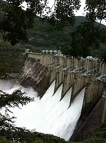
The Chungju Dam is a gravity dam on the Namhan River, 6 km (4 mi) northeast of Chungju in Chungcheongbuk-do Province, South Korea. The purpose of the dam is flood control, water supply and hydroelectric power generation. Construction on the dam began in 1978 and was complete in 1985. The 98 m (322 ft) tall dam withholds a reservoir of 2,750,000,000 m3 (2,229,461 acre⋅ft) and supplies water to a 400 MW power station.[3]
See also
References
- ↑ worldlakes
- ↑ Engineering news-record, Volume 209, Issues 21-26. McGraw-Hill. 1982. p. 43.
- ↑ "Multi-Purpose Dams". Korea Water Resources Corporation. Retrieved 4 August 2011.
Wikimedia Commons has media related to Chungju Dam.
This article is issued from Wikipedia. The text is licensed under Creative Commons - Attribution - Sharealike. Additional terms may apply for the media files.