| Churchill | |
|---|---|
 | |
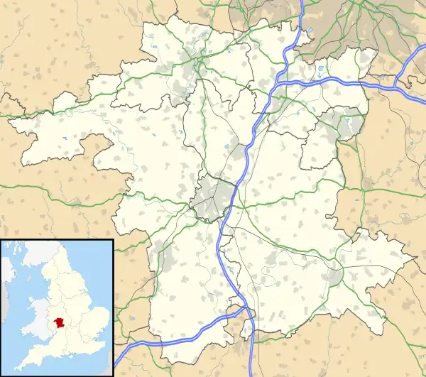  Churchill Location within Worcestershire | |
| Area | 2.72 km2 (1.05 sq mi) |
| Population | 24 (2001 census) |
| • Density | 9/km2 (23/sq mi) |
| Civil parish |
|
| District | |
| Shire county | |
| Region | |
| Country | England |
| Sovereign state | United Kingdom |
| Post town | WORCESTER |
| Postcode district | WR7 |
| UK Parliament | |
Churchill or Churchill by Spetchley[1] is a village and civil parish 4 miles (6.4 km) from Worcester,[2] in the Wychavon district, in the county of Worcestershire, England. In 2001 it has a population of 24.[3] The parish touches Bredicot, Broughton Hackett, Spetchley, Upton Snodsbury and White Ladies Aston.[4]
Features
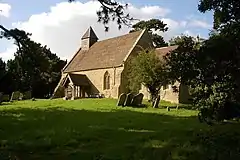
There are 8 listed buildings in Churchill.[5] Churchill has a church called St Michael's Church.[6]
History
The name "Churchill" means 'Crug hill'.[7] Churchill was recorded in the Domesday Book as Circehille.[8] Churchill was "Circehille", in the 11th century and "Cherchull", "Chirchehull" and "Cershull-juxta-Humelbrok" in the 13th century.[9]
References
- ↑ "Churchill by Spetchley". GENUKI. Retrieved 15 June 2020.
- ↑ "Distance from Churchill by Spetchley [52.181496, -2.114032]". GENUKI. Retrieved 15 June 2020.
- ↑ Neighbourhood Statistics
- ↑ "Churchill". Ordnance Survey. Retrieved 15 June 2020.
- ↑ "Listed Buildings in Churchill, Wychavon, Worcestershire". British Listed Buildings. Retrieved 15 June 2020.
- ↑ "Church of St Michael". Historic England. Retrieved 15 June 2020.
- ↑ "Churchill Key to English Place-names". The University of Nottingham. Retrieved 15 June 2020. Note that there are 2, select the more southerly red dot.
- ↑ "Worcestershire A-D". The Domesday Book Online. Retrieved 15 June 2020.
- ↑ "Parishes: Churchill". British History Online. Retrieved 15 June 2020.
- "Churchill". City Population De. Retrieved 1 October 2020.

Wikimedia Commons has media related to Churchill.
This article is issued from Wikipedia. The text is licensed under Creative Commons - Attribution - Sharealike. Additional terms may apply for the media files.