Clémencey | |
|---|---|
Part of Valforêt | |
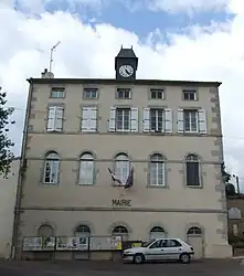 Town hall | |
.svg.png.webp) Coat of arms | |
Location of Clémencey | |
 Clémencey  Clémencey | |
| Coordinates: 47°14′53″N 4°52′59″E / 47.2481°N 4.8831°E | |
| Country | France |
| Region | Bourgogne-Franche-Comté |
| Department | Côte-d'Or |
| Arrondissement | Beaune |
| Canton | Longvic |
| Commune | Valforêt |
| Area 1 | 10.72 km2 (4.14 sq mi) |
| Population (2019)[1] | 120 |
| • Density | 11/km2 (29/sq mi) |
| Time zone | UTC+01:00 (CET) |
| • Summer (DST) | UTC+02:00 (CEST) |
| Postal code | 21220 |
| Elevation | 330–579 m (1,083–1,900 ft) |
| 1 French Land Register data, which excludes lakes, ponds, glaciers > 1 km2 (0.386 sq mi or 247 acres) and river estuaries. | |
Clémencey (French pronunciation: [klemɑ̃sɛ]) is a former commune in the Côte-d'Or department in eastern France. It is located 17 km south west of Dijon. On 1 January 2019, it was merged into the new commune Valforêt.[2]
Population
| Year | Pop. | ±% |
|---|---|---|
| 1962 | 37 | — |
| 1968 | 41 | +10.8% |
| 1975 | 41 | +0.0% |
| 1982 | 58 | +41.5% |
| 1990 | 59 | +1.7% |
| 1999 | 92 | +55.9% |
| 2008 | 120 | +30.4% |
See also
References
- ↑ Téléchargement du fichier d'ensemble des populations légales en 2019, INSEE
- ↑ Arrêté préfectoral 21 November 2018 (in French)
Wikimedia Commons has media related to Clémencey.
This article is issued from Wikipedia. The text is licensed under Creative Commons - Attribution - Sharealike. Additional terms may apply for the media files.