Clerval | |
|---|---|
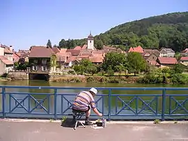
Part of Pays-de-Clerval | |
 | |
 Coat of arms | |
Location of Clerval | |
 Clerval  Clerval | |
| Coordinates: 47°23′35″N 6°29′54″E / 47.3931°N 6.4983°E | |
| Country | France |
| Region | Bourgogne-Franche-Comté |
| Department | Doubs |
| Arrondissement | Montbéliard |
| Canton | Bavans |
| Commune | Pays-de-Clerval |
| Area 1 | 11.83 km2 (4.57 sq mi) |
| Population (2014)[1] | 1,017 |
| • Density | 86/km2 (220/sq mi) |
| Time zone | UTC+01:00 (CET) |
| • Summer (DST) | UTC+02:00 (CEST) |
| Postal code | 25340 |
| Elevation | 274–550 m (899–1,804 ft) |
| 1 French Land Register data, which excludes lakes, ponds, glaciers > 1 km2 (0.386 sq mi or 247 acres) and river estuaries. | |
Clerval (French pronunciation: [klɛʁval]) is a former commune in the Doubs department in the Bourgogne-Franche-Comté region in eastern France. On 1 January 2017, it was merged into the new commune Pays-de-Clerval.[2]
Population
| Year | Pop. | ±% |
|---|---|---|
| 1962 | 1,168 | — |
| 1968 | 1,021 | −12.6% |
| 1975 | 1,176 | +15.2% |
| 1982 | 1,008 | −14.3% |
| 1990 | 925 | −8.2% |
| 1999 | 1,066 | +15.2% |
| 2008 | 1,030 | −3.4% |
| 2012 | 1,054 | +2.3% |
See also
References
- ↑ Populations légales 2014: Téléchargement du fichier d'ensemble, INSEE
- ↑ Arrêté préfectoral 9 August 2016 (in French)
Wikimedia Commons has media related to Clerval (Doubs).
This article is issued from Wikipedia. The text is licensed under Creative Commons - Attribution - Sharealike. Additional terms may apply for the media files.