| Cogra Moss | |
|---|---|
 | |
 Cogra Moss Location in the Lake District 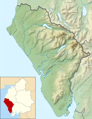 Cogra Moss Location in Copeland Borough | |
| Location | Lake District |
| Coordinates | 54°33′48″N 3°24′04″W / 54.56333°N 3.40111°W |
| Type | reservoir |
| Catchment area | 245 hectares (0.95 sq mi)[1] |
| Basin countries | United Kingdom |
| Surface area | 16 hectares (40 acres)[1] |
| Average depth | 5.4 metres (18 ft)[1] |
| Water volume | 0.84×10⁶ m3 (680 acre⋅ft)[1] |
| Shore length1 | 2 km (1.2 mi)[1] |
| Surface elevation | 225 metres (738 ft)[1] |
| 1 Shore length is not a well-defined measure. | |
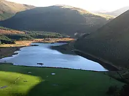
Cogra Moss is a shallow reservoir to the east of the village of Lamplugh on the western edge of the English Lake District.[2] It was created by the damming of Rakegill Beck in about 1880, though its function as a water supply ceased in 1975. The reservoir, which is surrounded by forestry plantations on three sides, is popular with walkers and anglers.[3]
References
- 1 2 3 4 5 6 "UK Lakes Detail". Eip.ceh.ac.uk. Archived from the original on 11 June 2016. Retrieved 30 March 2017.
- ↑ Ordnance Survey 1:63360 scale Touring map & guide: Lake District
- ↑ "Cogra Moss, Cumbria". Archived from the original on 19 September 2011. Retrieved 2 November 2011.
Wikimedia Commons has media related to Cogra Moss.
This article is issued from Wikipedia. The text is licensed under Creative Commons - Attribution - Sharealike. Additional terms may apply for the media files.