Coll de Nargó | |
|---|---|
 Coll de Nargó village | |
 Coat of arms | |
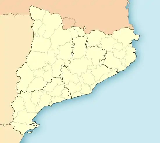 Coll de Nargó Location in Catalonia | |
| Coordinates: 42°10′24″N 1°19′0″E / 42.17333°N 1.31667°E | |
| Country | |
| Community | |
| Province | Lleida |
| Comarca | Alt Urgell |
| Government | |
| • Mayor | Martí Riera Rovira (2015)[1] |
| Area | |
| • Total | 151.4 km2 (58.5 sq mi) |
| Elevation | 753 m (2,470 ft) |
| Population (2018)[3] | |
| • Total | 549 |
| • Density | 3.6/km2 (9.4/sq mi) |
| Website | collnargo |

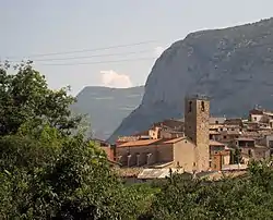
Romanesque church of Sant Climent, with its pre-Romanesque bell-tower
Coll de Nargó is a municipality in the comarca of the Alt Urgell in Catalonia, a region of Spain. It is situated in the Segre valley by the Oliana reservoir. The municipality is served by the C-14 road between Ponts and La Seu d'Urgell, the L-511 road to Isona and the L-401 road to Sant Llorenç de Morunys. The Romanesque church of Sant Climent dates from the eleventh century, and has a rectangular pre-Romanesque bell-tower.
Demographics
| 1900 | 1930 | 1950 | 1970 | 1986 | 2005 |
|---|---|---|---|---|---|
| 1389 | 1565 | 1511 | 847 | 684 | 600 |
Subdivisions
The municipality of Coll de Nargó includes five outlying villages. Populations are given as of 2001, when the population of the village of Coll de Nargó was 463:
- Gavarra (26), bordering the comarca of the Noguera
- Les Masies de Nargó (30)
- Montanissell (28), at the foot of the Sant Joan range
- Sallent (38), on the south side of the Sant Joan range, linked with Montanissell by a forest track
- Valldarques (15)
References
- ↑ "Ajuntament de Coll de Nargó". Generalitat of Catalonia. Retrieved 2015-11-13.
- ↑ "El municipi en xifres: Coll de Nargó". Statistical Institute of Catalonia. Retrieved 2015-11-23.
- ↑ Municipal Register of Spain 2018. National Statistics Institute.
External links
- Government data pages (in Catalan)
Places adjacent to Coll de Nargó | |
|---|---|
Municipalities of Alt Urgell | ||
|---|---|---|
This article is issued from Wikipedia. The text is licensed under Creative Commons - Attribution - Sharealike. Additional terms may apply for the media files.