Courry | |
|---|---|
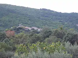 A general view of Courry | |
Location of Courry | |
 Courry  Courry | |
| Coordinates: 44°18′00″N 4°09′23″E / 44.3°N 4.1564°E | |
| Country | France |
| Region | Occitania |
| Department | Gard |
| Arrondissement | Alès |
| Canton | Rousson |
| Government | |
| • Mayor (2020–2026) | Jean Bernard[1] |
| Area 1 | 8.22 km2 (3.17 sq mi) |
| Population | 282 |
| • Density | 34/km2 (89/sq mi) |
| Time zone | UTC+01:00 (CET) |
| • Summer (DST) | UTC+02:00 (CEST) |
| INSEE/Postal code | 30097 /30500 |
| Elevation | 198–516 m (650–1,693 ft) (avg. 347 m or 1,138 ft) |
| 1 French Land Register data, which excludes lakes, ponds, glaciers > 1 km2 (0.386 sq mi or 247 acres) and river estuaries. | |
Courry (French pronunciation: [kuʁi]; Occitan: Corri) is a commune in the Gard department in southern France.
Population
| Year | Pop. | ±% p.a. |
|---|---|---|
| 1968 | 202 | — |
| 1975 | 179 | −1.71% |
| 1982 | 212 | +2.45% |
| 1990 | 218 | +0.35% |
| 1999 | 254 | +1.71% |
| 2009 | 309 | +1.98% |
| 2014 | 297 | −0.79% |
| 2020 | 280 | −0.98% |
| Source: INSEE[3] | ||
See also
References
- ↑ "Répertoire national des élus: les maires". data.gouv.fr, Plateforme ouverte des données publiques françaises (in French). 9 August 2021.
- ↑ "Populations légales 2021". The National Institute of Statistics and Economic Studies. 28 December 2023.
- ↑ Population en historique depuis 1968, INSEE
Wikimedia Commons has media related to Courry.
This article is issued from Wikipedia. The text is licensed under Creative Commons - Attribution - Sharealike. Additional terms may apply for the media files.