| Crvanj | |
|---|---|
 | |
| Highest point | |
| Elevation | 1,921 m (6,302 ft) |
| Coordinates | 43°22′55″N 18°10′30″E / 43.38194°N 18.17500°E |
| Geography | |
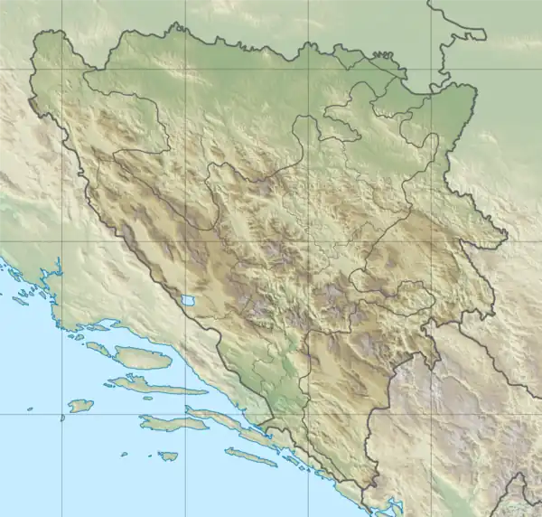 Crvanj Location in Bosnia and Herzegovina | |
| Location | |
| Parent range | Dinaric Alps |
Crvanj
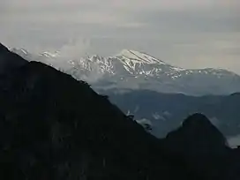
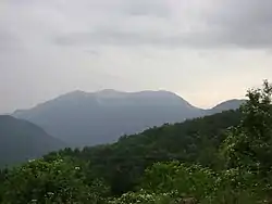
Crvanj (Serbian Cyrillic: Црвањ) is a mountain in the municipality of Nevesinje and Konjic Bosnia and Herzegovina. It has an altitude of 1,921 metres (6,302 ft).[1]
See also
References
- ↑ "Statistical Yearbook of the Federation of Bosnia and Herzegovina" (PDF). Federation of Bosnia and Herzegovina, Federal Office of Statistics. 2009. p. 28. Archived from the original (PDF) on 2011-06-29.
This article is issued from Wikipedia. The text is licensed under Creative Commons - Attribution - Sharealike. Additional terms may apply for the media files.