Tizimín Airfield Aeropuerto de Tizimín | |||||||||||
|---|---|---|---|---|---|---|---|---|---|---|---|
| Summary | |||||||||||
| Airport type | Civil | ||||||||||
| Serves | Tizimín, Yucatan, Mexico | ||||||||||
| Time zone | CST (UTC−06:00) | ||||||||||
| Coordinates | 21°9′19″N 88°10′20″W / 21.15528°N 88.17222°W | ||||||||||
| Map | |||||||||||
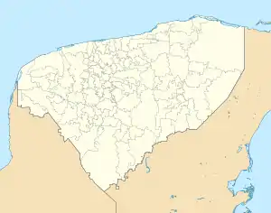 Location of the airfield in Yucatán  | |||||||||||
| Runways | |||||||||||
| |||||||||||
Tizimín Airfield (Spanish: Aeropuerto de Tizimín), also known as Aeropuerto Nacional Cupul (Cupul National Airport) (IATA: TZM) was an airfield located in Tizimín, Yucatan, Mexico. It served as the main airport for Tizimín, primarily accommodating general aviation activities. Over time, the airfield has been abandoned, with a new police station constructed on the eastern end of the runway. The closest airports currently handling commercial flights are Mérida International Airport and Cancún International Airport.
See also
References
- ↑ Airport information for TZM at Great Circle Mapper.
- ↑ Airport information for Cupul National Airport at Transport Search website.
External links
- Tizimín Airport information at Great Circle Mapper
- Aeronautical chart and airport information for MM72 at SkyVector
- Current weather for MM72 at NOAA/NWS
- Accident history for TZM at Aviation Safety Network
This article is issued from Wikipedia. The text is licensed under Creative Commons - Attribution - Sharealike. Additional terms may apply for the media files.