| Dürre Ager | |
|---|---|
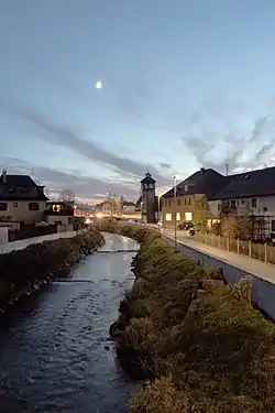 The Dürre Ager in Timelkam | |
| Location | |
| Country | Austria |
| State | Upper Austria |
| Physical characteristics | |
| Source | |
| • location | Upper Austria |
| Mouth | |
• location | at Timelkam into the Vöckla |
• coordinates | 48°00′17″N 13°36′35″E / 48.0047°N 13.6097°E |
| Length | 31.3 km (19.4 mi) [1] |
| Basin features | |
| Progression | Vöckla→ Ager→ Traun→ Danube→ Black Sea |
The Dürre Ager is a river of Upper Austria.
The Dürre Ager flows through the Attergau area from south to north passes through St Georgen im Attergau. It joins the Vöckla at Timelkam. It has a length of approximately 22.5 kilometres (14.0 mi).
References
- ↑ DORIS Atlas (Upper Austria)
This article is issued from Wikipedia. The text is licensed under Creative Commons - Attribution - Sharealike. Additional terms may apply for the media files.