Dabakala | |
|---|---|
Town, sub-prefecture, and commune | |
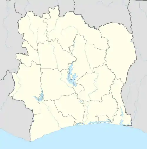 Dabakala Location in Ivory Coast | |
| Coordinates: 8°22′N 4°26′W / 8.367°N 4.433°W | |
| Country | |
| District | Vallée du Bandama |
| Region | Hambol |
| Department | Dabakala |
| Area | |
| • Total | 1,940 km2 (750 sq mi) |
| Population (2021 census)[1] | |
| • Total | 78,634 |
| • Density | 41/km2 (100/sq mi) |
| • Town | 14,134[2] |
| (2014 census) | |
| Time zone | UTC+0 (GMT) |
Dabakala is a town in northeast Ivory Coast. It is a sub-prefecture of and the seat of Dabakala Department in Hambol Region, Vallée du Bandama District. Dabakala is also a commune.
In 2021, the population of the sub-prefecture of Dabakala was 78,634.[1]
Villages
The 25 villages of the sub-prefecture of Dabakala and their population in 2014 are:[3]
- Bakoro Séoula (374)
- Bakoro Sobara (1 139)
- Boniérédougou (3 002)
- Bounadougou (1 125)
- Broubrou Dioulasso (464)
- Kahatadougou (147)
- Karpélé (1 224)
- Kayoulo (551)
- Kokolo (335)
- Koundodougou (1 779)
- Loniéné (894)
- Oualéguéra (728)
- Palagadougou (504)
- Souroukoudougou (937)
- Tiékélédougou (411)
- Tienguindougou (1 737)
- Tossiondougou (287)
- Yéoulesso (355)
- Bokala Noumousso (1 205)
- Bokala-Niampondougou (1 688)
- Gboly Carrefour (1 006)
- Kofila (725)
- Pinsolodougou (1 383)
- Sendé (639)
- Souleymanekaha (626)
Notes
- 1 2 Citypopulation.de Population of the regions and sub-prefectures of Ivory Coast
- ↑ Citypopulation.de Population of cities & localities in Ivory Coast
- ↑ Citypopulation.de
Regional seat: Katiola | ||
| Dabakala Department | 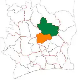 | |
| Katiola Department | ||
| Niakaramandougou Department | ||
* also a commune | ||
This article is issued from Wikipedia. The text is licensed under Creative Commons - Attribution - Sharealike. Additional terms may apply for the media files.