Darbydale, Ohio | |
|---|---|
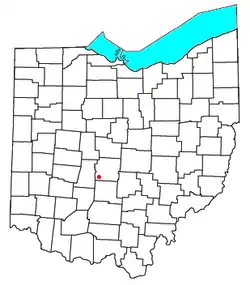 Location of Darbydale, Ohio | |
| Coordinates: 39°51′12″N 83°11′2″W / 39.85333°N 83.18389°W | |
| Country | United States |
| State | Ohio |
| County | Franklin |
| Township | Pleasant |
| Area | |
| • Total | 1.01 sq mi (2.63 km2) |
| • Land | 1.00 sq mi (2.58 km2) |
| • Water | 0.02 sq mi (0.05 km2) |
| Elevation | 870 ft (270 m) |
| Population (2020) | |
| • Total | 768 |
| • Density | 771.08/sq mi (297.75/km2) |
| Time zone | UTC-5 (Eastern (EST)) |
| • Summer (DST) | UTC-4 (EDT) |
| ZIP code | 43123 |
| FIPS code | 39-20198 |
| GNIS feature ID | 1048650 |
Darbydale is an unincorporated community and census-designated place (CDP) in central Pleasant Township, Franklin County, Ohio, United States.[2] It was an incorporated village until its disincorporation on December 27, 1985.[3] As of the 2020 census, the population was 768.
The community is located in the southwest part of Franklin County, on the north side of Big Darby Creek, a tributary of the Scioto River. It is 14 miles (23 km) southwest of downtown Columbus.
Demographics
| Census | Pop. | Note | %± |
|---|---|---|---|
| 2010 | 793 | — | |
| 2020 | 768 | −3.2% | |
| U.S. Decennial Census[4] | |||
References
- ↑ "ArcGIS REST Services Directory". United States Census Bureau. Retrieved September 20, 2022.
- ↑ U.S. Geological Survey Geographic Names Information System: Darbydale, Ohio
- ↑ Albrecht, Robert (March 8, 1997). "County map tells the tale of growth". Columbus Dispatch. Pg 4B.
- ↑ "Census of Population and Housing". Census.gov. Retrieved June 4, 2016.
Municipalities and communities of Franklin County, Ohio, United States | ||
|---|---|---|
| Cities |  Map of Ohio highlighting Franklin County | |
| Villages | ||
| Townships | ||
| CDPs | ||
| Unincorporated communities | ||
| Footnotes | ‡This populated place also has portions in an adjacent county or counties | |
This article is issued from Wikipedia. The text is licensed under Creative Commons - Attribution - Sharealike. Additional terms may apply for the media files.