Deest | |
|---|---|
Village | |
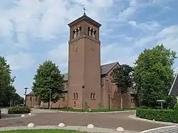 Church of Deest | |
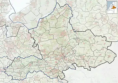 Deest Location in the Netherlands  Deest Deest (Netherlands) | |
| Coordinates: 51°53′N 5°40′E / 51.883°N 5.667°E | |
| Country | Netherlands |
| Province | Gelderland |
| Municipality | Druten |
| Area | |
| • Total | 5.58 km2 (2.15 sq mi) |
| Elevation | 8 m (26 ft) |
| Population (2021)[1] | |
| • Total | 1,790 |
| • Density | 320/km2 (830/sq mi) |
| Time zone | UTC+1 (CET) |
| • Summer (DST) | UTC+2 (CEST) |
| Postal code | 6653[1] |
| Dialing code | 0487 |
Deest is a village in the Dutch province of Gelderland. It is a part of the municipality of Druten, and lies about 9 km south of Wageningen.
History
It was first mentioned in 814 as T(h)esta (CL I, no. 101) and 997 as Dheste. The etymology in unknown.[3] In 1840, it was home to 451 people.[4] Deest became an independent parish in 1858 when the first church was built.[4] In 1919, the brickworks Vogelensangh opened, and is still in operation.[4]
On 3 February 1945, the monastery was hit by a V-1 flying bomb killing seven sisters, two women and two children. On 8 February, another V1 hit the village killing 10 people. Most of the centre was destroyed. In 1953, the church was rebuilt.[5]
Gallery
_Rijksmonument_523802_Uiversnest_schuur_Van_Heemstraweg_2a.JPG.webp) Barn in Deest
Barn in Deest House in Deest
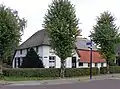 Farm in Deest
_Rijksmonument_523809_Steenoven_Vogelsangh.JPG.webp) Brickworks
Brickworks
References
- 1 2 3 "Kerncijfers wijken en buurten 2021". Central Bureau of Statistics. Retrieved 21 March 2022.
- ↑ "Postcodetool for 6653AA". Actueel Hoogtebestand Nederland (in Dutch). Het Waterschapshuis. Retrieved 21 March 2022.
- ↑ "Deest - (geografische naam)". Etymologiebank (in Dutch). Retrieved 21 March 2022.
- 1 2 3 "Deest". Plaatsengids (in Dutch). Retrieved 21 March 2022.
- ↑ "In februari 1945 verloor Deest haar hart". Mijn Gelderland (in Dutch). Retrieved 21 March 2022.
This article is issued from Wikipedia. The text is licensed under Creative Commons - Attribution - Sharealike. Additional terms may apply for the media files.