Dietmanns | |
|---|---|
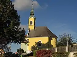 Dietmanns chapel | |
 Coat of arms | |
 Dietmanns Location within Austria | |
| Coordinates: 48°47′00″N 15°22′00″E / 48.78333°N 15.36667°E | |
| Country | Austria |
| State | Lower Austria |
| District | Waidhofen an der Thaya |
| Government | |
| • Mayor | Harald Hofbauer (SPÖ) |
| Area | |
| • Total | 6.87 km2 (2.65 sq mi) |
| Elevation | 622 m (2,041 ft) |
| Population (2018-01-01)[2] | |
| • Total | 1,063 |
| • Density | 150/km2 (400/sq mi) |
| Time zone | UTC+1 (CET) |
| • Summer (DST) | UTC+2 (CEST) |
| Postal code | 3813 |
| Area code | 02847 |
| Vehicle registration | WT |
| Website | www.dietmanns.gv.at |
Dietmanns is a municipality in the region Waldviertel district of Waidhofen an der Thaya in the Austrian state of Lower Austria.
Population
| Year | Pop. | ±% |
|---|---|---|
| 1971 | 1,316 | — |
| 1981 | 1,262 | −4.1% |
| 1991 | 1,202 | −4.8% |
| 2001 | 1,243 | +3.4% |
References
- ↑ "Dauersiedlungsraum der Gemeinden Politischen Bezirke und Bundesländer - Gebietsstand 1.1.2018". Statistics Austria. Retrieved 10 March 2019.
- ↑ "Einwohnerzahl 1.1.2018 nach Gemeinden mit Status, Gebietsstand 1.1.2018". Statistics Austria. Retrieved 9 March 2019.
External links
Wikimedia Commons has media related to Dietmanns, Lower Austria.
This article is issued from Wikipedia. The text is licensed under Creative Commons - Attribution - Sharealike. Additional terms may apply for the media files.