Erigavo Airport | |||||||||||
|---|---|---|---|---|---|---|---|---|---|---|---|
| Summary | |||||||||||
| Owner | Somaliland Civil Aviation and Airports Authority | ||||||||||
| Operator | Estabilished 1950 | ||||||||||
| Serves | Erigavo, Somaliland | ||||||||||
| Location | Erigavo, Somaliland | ||||||||||
| Elevation AMSL | 5,853 ft / 1,784 m | ||||||||||
| Coordinates | 10°38′32″N 047°23′17″E / 10.64222°N 47.38806°E | ||||||||||
| Map | |||||||||||
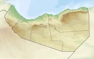 ERA Location of airport in Somaliland | |||||||||||
| Runways | |||||||||||
| |||||||||||
Source:[1] | |||||||||||
Erigavo Airport (IATA: ERA[2], ICAO: HCMU) is an airport serving Erigavo[1][3] (Somali: Garoonka Diyaaradaha ee Ceerigaabo), the capital of the Sanaag region in Somaliland.
Facilities
The airport resides at an elevation of 5,853 feet (1,784 m) above mean sea level. It has a runway which is 2,000 metres (6,562 ft) long.[1]
Tower Frequency: 121.000
MET Available 02:00Z-15:00Z
References
- 1 2 3 Airport information for Erigavo, Somaliland (HCMU / ERA) at Great Circle Mapper.
- ↑ "IATA Airport Code Search (ERA: Erigavo)". International Air Transport Association. Retrieved 23 September 2013.
- ↑ Erigavo Airport (ERA), Somalia at World-Airport-Codes.com
External links
- Aeronautical chart at SkyVector
- Accident history for ERA at Aviation Safety Network
This article is issued from Wikipedia. The text is licensed under Creative Commons - Attribution - Sharealike. Additional terms may apply for the media files.